-
France 2021 inheritance law: Why wills choosing Scots law may be exempt from forced heirship
The same may also apply to wills electing law from one US state
-
France records over 90 cases of mosquito-borne diseases in May
All infections were linked to travel abroad
-
Spain’s new speed cameras can catch drivers ‘before they have time to brake’
The new laser-based AI speed cameras can identify vehicles from over 200 metres away
MAP: How to see where wildfires are in France in real time
With several blazes currently active around the country, we look at how you can track the fires
There are several ways to track the various wildfires around France, such as the one in Gironde that ravaged around 6,000 hectares of forest overnight between Tuesday and today (August 10).
Read more: Homes destroyed as south-west France wildfire reignites overnight
This is just one of many active blazes that have been caused by a combination of high temperatures, drought and in some cases, irresponsible or illegal behaviour.
Read more: 3,000 people evacuated as wildfire spreads in southern France
Read more: Drought map update: See the French departments with water restrictions
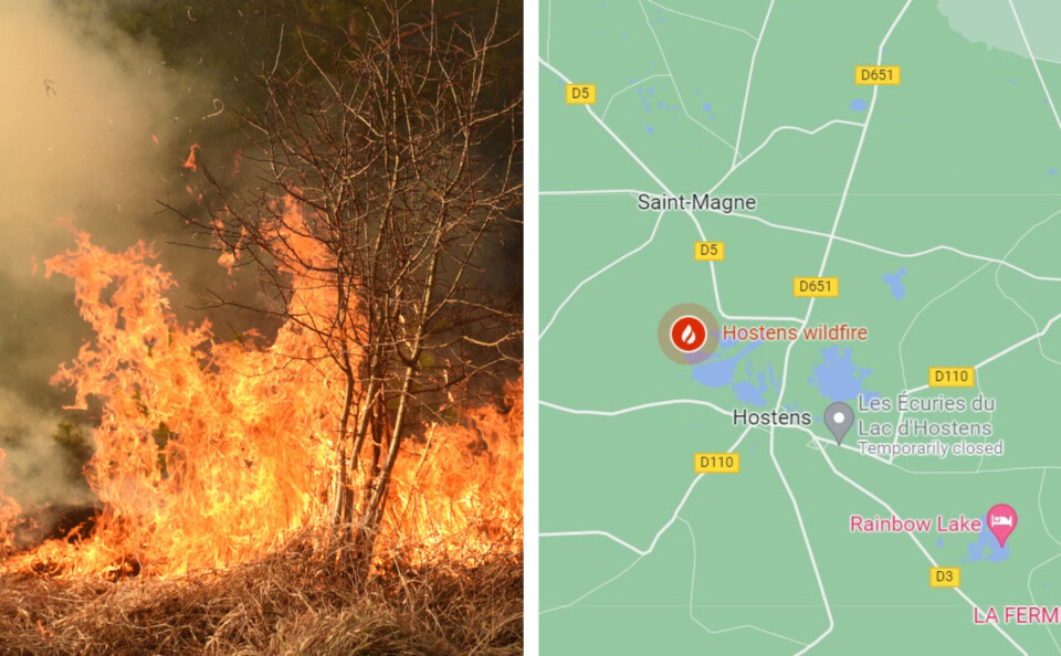
One way to see where the fires are is using Google Maps. You first need to know roughly where the fire is, then you simply go to that location on the map and you will see a symbol of a fire, including details of when the symbol was last updated.
In the picture below, you will see that the Gironde wildfire is marked on Google Maps.

Screenshot / Google Maps
It should be noted that the symbol on Google denotes the approximate area of the fire, which could differ slightly in reality. Additionally, Google Maps does not mark every single wildfire currently active in France.
For a more scientific overview of the fires in France, you can use the NASA-made platform FIRMS (Fire Information for Resource Management System), or the European platform Copernicus.
Both these platforms use accurate and up-to-date data to track wildfires.
The image below is a screenshot of the Copernicus platform. You can see the huge Gironde blaze marked with a white smudge, just south of Bordeaux.
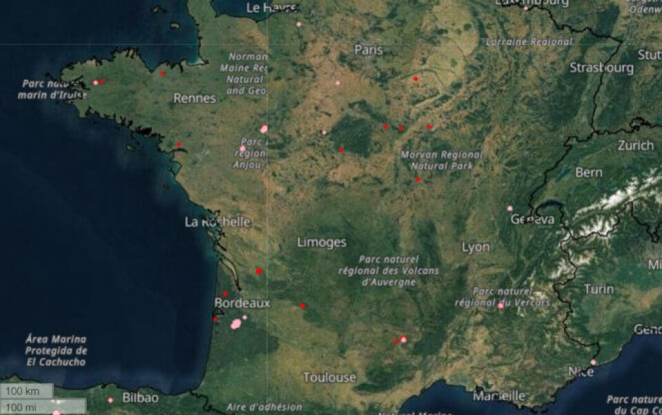
Screenshot / COPERNICUS
Related articles
How are French authorities informing people of water restrictions?
French drought measures: How much water do household appliances use?
Second volunteer firefighter arrested over fires in south of France


