-
MP drops plan to allow bakeries to open seven days a week
Proposal abandoned after opposition from the baking industry
-
Dog owners warned after outbreak of deadly virus in Avignon
Owners told to keep unvaccinated pets at home
-
Rescuers in French Pyrenees warn against reckless hiking
Concerns raised after two 19-year-olds rescued following 20-hour ordeal
Haute-Garonne and Tarn still on orange alert as winds reach 120km/h
Gusts reached their maximum intensity overnight and remain strong this morning although they are expected to calm this afternoon
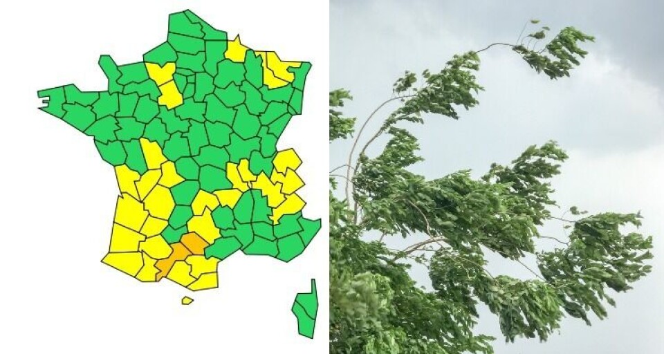
Haute-Garonne and Tarn in south-west France remain under an orange weather warning today (April 12), after gusts of up to 120km/h were recorded overnight around Castres.
🔶 2 dpts en #vigilanceOrange
— VigiMétéoFrance (@VigiMeteoFrance) April 12, 2022
Restez informés sur https://t.co/rJ24zzmmy4 pic.twitter.com/2QeUVsaS0w
This is because of the Autan wind, which blows from the south west of France, spreading across Occitanie and Nouvelle-Aquitaine two or three times a year.
Read more: Haute-Garonne and Tarn on orange weather alerts for strong winds
Last night, wind speeds reached 80-90km/h around Toulouse, 100km/h on higher ground in Tarn, 102km/h at Toulouse-Blagnac Airport and 120km/h around Castres and the Lauragais area south-east of Toulouse.
The wind has abated somewhat this morning, but the area around Toulouse is still experiencing gusts of 60-75km/h and the Lauragais and Montagne Noire regions are seeing speeds of 100-115km/h.
The wind will calm this afternoon, and the orange alert should end at 16:00, although there will still be some strong gusts overnight tonight.
Some of the departments surrounding Haute-Garonne and Tarn, including Aveyron, Gers, Haute-Pyrénées and Ariège, also remain under yellow weather alerts.
Do I need to do anything?
The strong winds could cause issues with power supply and telephone lines, as well as road disruption.
Local residents should watch out for falling objects such as branches or roof tiles, and are advised to secure any possessions which could be blown away.
Advertisement
You should also try to avoid going out if possible.
You can find out more on the Météo France website.
Related articles
Storms, avalanches - and a record 26.1C: All in same day in France
French lottery winner uses €200m fortune to fight climate change