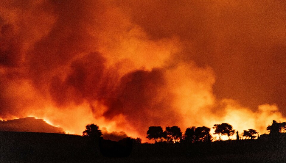
Warnings over potential forest fires will reach their highest level in six southern departments tomorrow (July 1), as strong winds and a lingering heatwave combine.
On Tuesday (June 30), eight departments are on a ‘high’ risk alert for forest fires by state forecaster Météo France.
By Wednesday, however, six departments – Bouches-du-Rhône, Vaucluse, Gard, Hérault, Aude, and Pyrénées-Orientales – will see this rise to a red ‘very high’ alert, the most severe.
A combination of strong Mistral and Tramontane winds (up to 80km/h in some areas including the Var) alongside dried out vegetation from a lack of rainfall in the departments, greatly increases the risk of fires spreading.
Météo France is warning of this combination becoming an issue across much of France in the coming weeks, after June’s record heatwave and a lack of rainfall since the spring.
Hundreds of communes across France have already issued water restrictions, with most departments now implementing reminders over sensible tap water consumption to reduce the threat of summer droughts.
The forest fire threat in the south is also heightened by the warmer than average temperatures in the area, as all departments listed above remain on a tier-two yellow alert for heatwave conditions.
This both increases the risk of natural fires occurring, as well as fires caused by human behaviour.
Barbecues for example are more common in hot weather, and accidental fires resulting from mistakes caused by heat-induced fatigue are also a risk.
The forest fire risk map follows a similar pattern to France’s official weather alerts, with a four-colour tiered warning system.
It is also published one day in advance, meaning you should check back each day to see the map for the following day.
It does not show where current fires are burning, but instead the risk of a fire starting in a certain location. You can read more about how the map works in our article here.
If you live in one of the departments on a red-tier alert, it is worth checking local prefecture websites or contacting your local mairie to see if any restrictions are in place.
During high-risk periods, certain wooded areas may be closed to the public to reduce the risk of accidental fires, and certain works including property renovations temporarily halted.