






New map shows most of France at risk from clay soil cracking
Map is official tool for insurance and property sales


Published


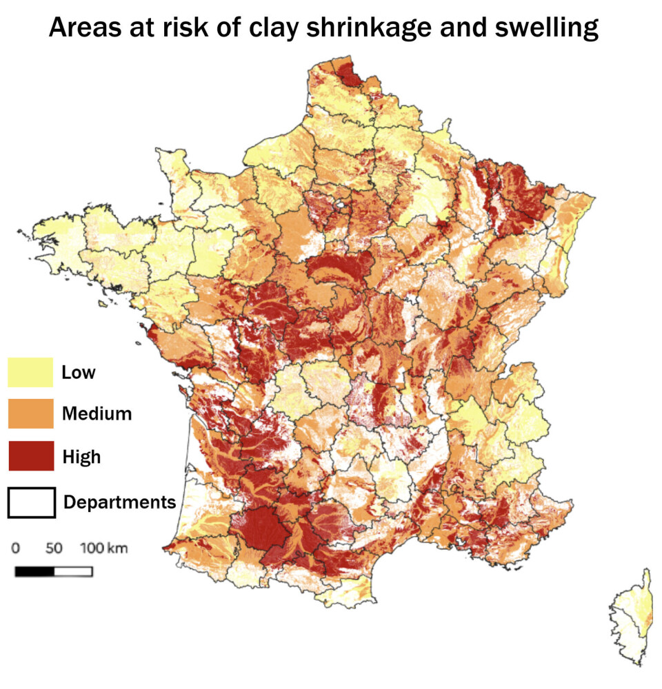
A new map showing areas of France at risk from clay soil shrinkage and expansion became an official tool for insurance and property sales on July 1.
The map, unveiled in February, shows that 55% of France is exposed to the risk, up from 48% under the previous map published in 2020.
It uses data from insurance claims following the 2023 heatwave and identifies a greater number of departments at risk.
Buyers must be warned
When a property in an affected area is sold, prospective buyers must be informed of the risk of damage caused by clay soil movement.
The risk arises because clay shrinks during periods of drought and expands when it becomes wet again, potentially causing cracks and other damage to buildings.
Homeowners and prospective buyers can check the risks affecting a property through the French government's Géorisques website, at georisques.gouv.fr.


