-
Satellite photos reveal scale of recent wildfires in France
Before-and-after images show extent of damage
-
EasyJet cabin crew in France file strike notice
Unions act after failed talks with management
-
French railway carriage turned holiday home with its own tunnel for sale in Dordogne
‘Everyone knows me as someone who takes on projects, but this was really a bit crazy - buying a tunnel’
France weather outlook: mini cold-snap for north, ice and flood alerts
A third of departments face warnings for back ice on roads
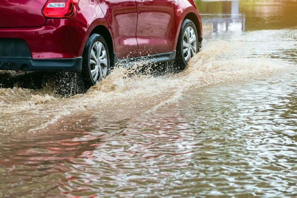
Extended rainfall across the east of France is causing heightened weather alerts in five mountainous departments today (December 1), with up to 80mm of rainfall expected in some areas.
Alpes-de-Haute-Provence, Hautes-Alpes, Isère, and Savoie face tier-three orange warnings for heavy rain/flash flooding while Haute-Savoie faces a tier-three warning for heavy rain and river flooding.
In addition, Haute-Savoie, Ain, Isère, Ain, and Loire are also facing tier-three alerts for icy conditions, from 18:00 onwards.
Rain will continue during the day with heightened flood warnings set to be lifted during the night.
Chilly morning temperatures (up to -3 north of the Seine) also means 35 central and northern departments are on a tier-two yellow alert for black ice / icy road conditions, and departments in the south-west for river flooding and high waves.
You can keep up to date with the weather warnings on the Météo France website.
Despite the cool morning temperatures, by the afternoon average highs for the beginning of December will be felt in most areas, and in the south-east, temperatures could reach up to 17C.
Snow is expected in higher altitudes – 800m and higher in the Vosges and Jura, 1,200m in the Massif Central, and 1,500m in the Alps and Pyrénées.
What about the weekend?
Tomorrow (December 2) will see the heightened rain warnings disperse, however the orange alert for river flooding in Haute-Savoie will remain.
In November, the department was placed on red alert after heavy flooding near Annemasse.
Early forecasts are that many departments will face tier-two warnings for river flooding, particularly in the south, west, and north, as rain continues.
In the south, a ‘Mistral’ wind will be felt in full force, particularly in Corsica where winds of between 120 km/h and 150 km/h will hit. At some coastal points, the galescould reach 180 km/h.
Sunday (December 3) will see a rainy and cloudy north, with a crisp yet sunny south.
A mini ‘cold-snap’ in the north and north-east could see morning temperatures as low as -8C in some places, and struggle to reach above 0C throughout the weekend.
However, expansive clouds are expected to bring rain from Sunday night onwards, spreading inland from the Atlantic ocean and hitting most of France early next week.
Forecasters believe this stretch of rain will last until Tuesday evening, however there is not yet enough information on the intensity.
Related articles
What to do (and not do) during heavy rain and flood alerts in France


