-
‘It was like a hallucination’ - French curator opens up about discovery of Mozart manuscript
Composition written by Mozart and his student given world premiere earlier this week in Paris
-
Ryanair reluctantly drops family seating charge after regulatory pressure
The move follows an investigation by the UK’s Competition and Markets Authority
-
British woman dies in French campsite during extreme heatwave
The elderly woman fell ill while staying at the campsite
Heightened alerts for heavy rain and floods in southern France
Intense storms are set to hit from tonight, lasting several days, and may spread to other areas
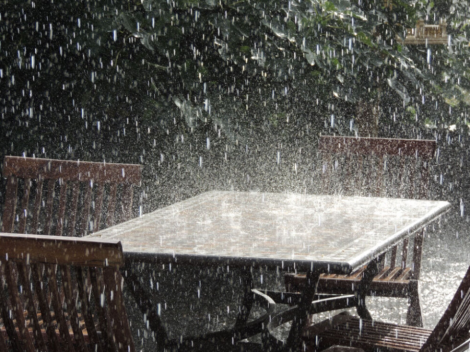
The south of France is bracing for a week of wet weather, with two departments on high alert for heavy rain and flooding.
Rain is forecast from today but more is to come on Wednesday (October 18) with the arrival of an épisode cévenol, bringing intense rain for several days.
Gard and Hérault are on tier-three (orange) alert for rain and flooding and tier-two yellow alert for storms. Lozère, Aveyron and Ardèche are also on alert for rain and flooding.
Ten other departments, from Brittany and Normandy in the north to the Pays-Basque in the south west, are also on high alert due to the strong winds forecast for Wednesday.
Only two departments have officially been placed on a tier-three alert but there is a strong chance others could join them as the storms develop.
The épisode cévenol could bring up to 25cm of rain in two days to some areas, the equivalent of a month and a half of usual rainfall.
More departments expected to be added
Météo France regularly updates its alert system so more departments are expected to be impacted on Tuesday night or Wednesday morning.
Episode cévenol storms are notorious for their sudden and often extremely localised nature, which can lead to devastating floods within one valley and relative calm in another.
If you live in the areas concerned, you should keep up to date with local weather reports. You can check the Météo France website here.
La Chaîne Météo, a weather forecaster owned by Le Figaro, is warning of severe weather conditions (the equivalent to a tier-three orange alert by Météo France) in four departments.
In addition to Hérault and Gard, it anticipates the same severity of weather in Lozère and Aveyron.
Alongside the rain, La Chaîne Météo forecasts:
-
“Rapid flooding” of rivers in the Cévennes hills that could burst riverbanks
-
“Thunderstorms with little mobility” that cause runoffs and flooding
-
“Strong sea winds” by the coast, up to 80 km/h, which may cause coastal flooding in the Gard and Hérault
The épisode cévenol will lose its intensity by Thursday evening although some effects could linger until Friday afternoon.
Read more: What to do (and not do) during heavy rain and flood alerts in France
More bad weather set to arrive in south-east
As the épisode cévenol begins to subside in Cévennes and western Mediterranean areas on Thursday evening, storms are expected, possibly lasting into the weekend in the south-east near the Italian border.
Heavy rain is expected to begin on Wednesday night around Nice, potentially lasting until Saturday morning, with storms set to hit the area on Thursday and Friday. Around 25cm of rainfall is expected there over the course of the week.
La Chaîne Météo is also predicting the spread of storms to the south-east.
Related articles:
France storm warnings continue: tips on how to secure your property
Storms in France: what to do if at home, out walking or in car


