
-
Meat withdrawn from French supermarkets over E.Coli risk
Lidl and Super U among stores selling potentially impacted ground beef
-
Ryanair becomes most popular carrier at Toulouse airport
Several low-cost carriers are targeting the French city with route expansions
-
New reports of Britons missing flights due to EES delays
Queues of several hours reported in Spain prior to full EES rollout
Alert raised as gusts of up to 110km/h expected in south-west France
Residents of Tarn and Haute-Garonne are urged to take care, especially around Toulouse
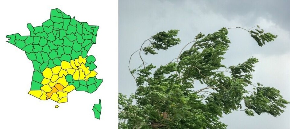
An orange weather warning for strong winds is in place this morning (March 15) for the departments of Tarn and Haute-Garonne in south-west France.
The wind began last night but will reach its “maximum” strength over the course of today.
🔶 2 dpts en #vigilanceOrange
— VigiMétéoFrance (@VigiMeteoFrance) March 14, 2022
Restez informés sur https://t.co/rJ24zzmmy4 pic.twitter.com/TwNNtz0S93
Average wind speeds of 50-65km/h and gusts of 100-110km/h or more are expected around Toulouse and surrounding areas as the Autan wind takes hold, lasting until this evening.
The Autan is a wind which blows from the south west of France, generally affecting the Languedoc and Guyenne – which spreads across the more northerly areas of Occitanie and Nouvelle Aquitaine – two or three times a year.
Beginning along the Mediterranean coastline, the Autan gathers speed as it moves over the Pyrenees and Massif Central, and is sometimes called the “devil’s wind,” as its gusts can damage harvests.
Overnight, the wind reached 111km/h in St-Félix du Lauragais, 101km/h at Toulouse-Blagnac airport and 98km/h in Tanus.
Advertisement
Although the wind will calm towards evening, it will remain strong on higher ground.
The departments surrounding Tarn and Haute-Garonne – including Gers, Tarn-et-Garonne and Aveyron – are also on a yellow weather alert for wind, although the gusts will not be as powerful in these areas.
Do I need to do anything?
The strong winds could cause power cuts and affect telephone cables. Residents should be careful of falling roof slates or branches.
Météo France advises that people stay at home and secure any possessions which could be blown away by the wind.
Related articles
Roads blocked and homes evacuated as heavy rain hits southern France
Floods, heatwaves: New report predicts global warming effect on France


