-
Surprise train strike to hit Normandy this weekend
Close to 40% of trains to destinations such as Evreux, Caen, and Rouen cancelled on Friday
-
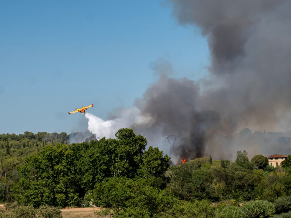
French farmers clash with prefecture over help for firefighters
Farmers hurry to deliver water and supplies, but authorities say they must use official channels
-
World’s largest Celtic festival begins this weekend in Brittany
The 55th edition of France’s huge ‘Interceltic’ celebration is dedicated to Cornwall and the Celtic Sea
France will soon roll out a ‘wildfire risk map’. How will it work?
Daily maps will inform firefighters and the public of at-risk areas as France bids to avoid another year of record forest fires
A new ‘forest fire map’ will be rolled out on June 1 aimed at helping people in France identify the areas most at risk from blazes.
The map will be updated daily and include four risk categories showing the threat of wildfires across all of France.
Authorities believe it will help reduce the damage caused by wildfires by allowing resources to be pre-emptively deployed to contain the spread of fires.
Some firefighters do not back the plan, however, believing resources are already too limited for such activities – and that making this information publicly available could spur on arsonist activity.
Similar to France’s weather vigilance map
Forest fire season has already begun in France, with a blaze in April engulfing nearly 1,000 hectares of land in Pyrénées-Orientales.
It is a worrying sign that devastation this year could match last year’s, where around 70,000 hectares of land were destroyed in France.
Ideas for a ‘forest fire map’ have been in the works since last July, and the project will run annually from mid-May to September – however this year the map will debut at the beginning of June.
Similar to the current Météo France Vigilance page for weather warnings, the map will consist of four threat levels, and be broken down on a departmental basis.
“We will know the risks [area by area] and there will be a more detailed level of information for the rescue forces,” said Christophe Béchu, Minister for Ecological Transition.
In turn, it will allow authorities “to position in advance the equipment and to coordinate the rescue services,” he added.
To analyse risk levels, a number of criteria will be measured by Météo France, including recent rain levels, humidity, air temperature, wind strength and vegetation information, among others.
This information is already available to some authorities in the ‘forest weather index’, but the map will open up access to the information for all and help response teams anticipate potential interventions.
“It will allow us to prepare our agents. In concrete terms, when there is a risk of a storm, we anticipate, we put more staff on call, we check the equipment... It's the same idea here: to anticipate the outbreak of fires,” said Jean-Paul Bosland, President of the National Federation of Firefighters.
Read more: How France wants to stop another record year of wildfires
‘We cannot put gendarmes in every forest’
Not everyone backs the map, however, with some arguing the risks of making the information public could outweigh the benefits.
Ministry reports state that around 90% of forest fires are started by humans – although many of these are accidental, making high-risk areas known to the public could lead to exacerbated damage by arsonists.
On top of this, there may not be enough manpower – or resources – for services to pre-emptively tackle each incident.
“We are not going to be able to put gendarmes at every forest entrance,” said Thierry, a resident in the south of France who runs a website dedicated to keeping track of forest fires.
A number of anonymous firefighters align themselves with Thierry’s concerns, according to Le Parisien – with forest fires possible across swathes of the country, there is only so much they can do.
Your feedback
Do you think the map is a good idea, or dangerous? Will it help firefighters, or simply highlight a lack of resources for emergency services? Let us know over at news@connexionfrance.com
Related articles
Forest fires in France: Cameras to be used more to prevent blazes
Putting down roots: French departments plant tree for each child born


