-
France’s Assurance Maladie pushes to ban smoking for young people
Health agency seeks to follow UK example in creating a ‘tobacco-free generation’
-
European airports at ‘critical point’ due to EES, warns trade body
Five-hour queues reported as calls for EES suspensions grow
-
This French bug spray could be your best defence against mosquito bites this summer
Mosquito repellent came top in consumer test as experts warn of ongoing risk from tiger mosquitoes in France
Weather alerts continued in France today with schools and roads closed
One department faced a red alert warning overnight, 66 departments nationwide are still on yellow alert
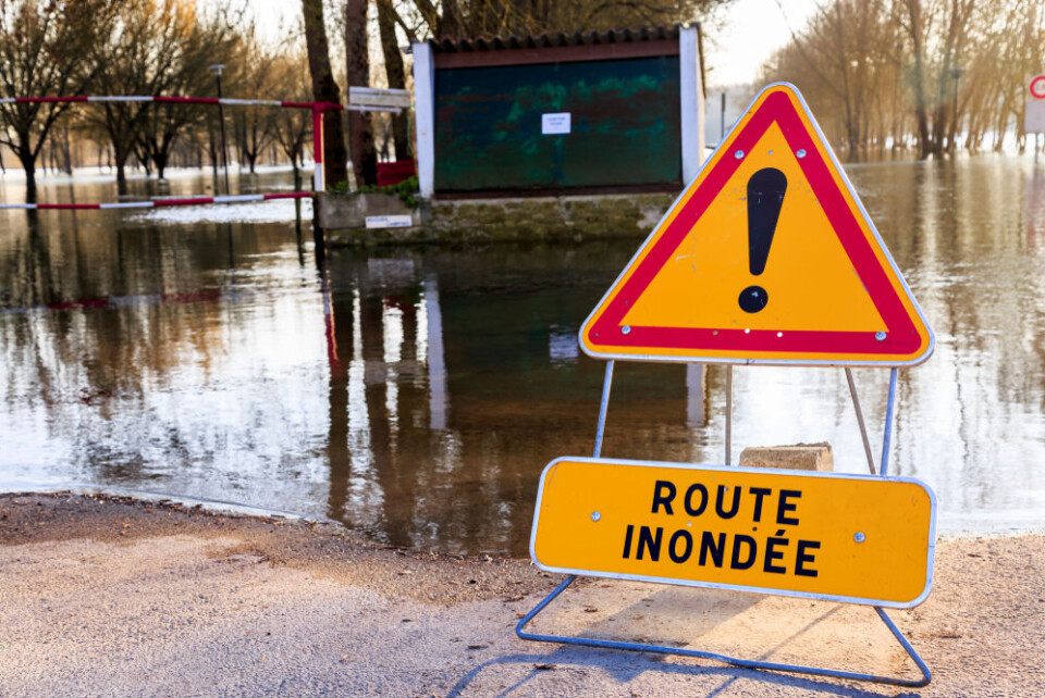
Over two-thirds of French departments are still facing weather warnings on Friday (October 20), as a number of intense storms continued to hit the country.
In the south-east, the Alpes-Maritimes department faced a red alert (the highest possible) for heavy rain and flooding overnight, as the final thrust of an épisode cévenol storm hit the area.
Alongside this, six other departments in the area are facing tier-three orange warnings for heavy rain, river floods, and coastal flooding.
Elsewhere 66 other departments in France – almost all of the south barring a couple of departments in Occitanie, as well as the capital region, the east and the north – faced 'yellow' weather warnings.
These were mostly for stormy weather and strong winds, but also partially for coastal and river flooding and heavy rain.
The majority of warnings are set to subside by Saturday, before Sunday sees a return to calmer weather.
Rains batter south-east
Alpes-Maritimes was placed on a tier-four red warning overnight due to heavy rainfall and the potential for flooding.
Residents in urban areas and valleys within the department were warned about the rain, with certain buildings – including schools – shut on Friday due to the intensity of the downpour.
In Nice parks were closed and the city’s beach was placed off-limits this morning until further notice, due to the risk of coastal flooding and heavy rain.
In some places in the department, including Saint-Martin-Vésubie, over 150mm of rainfall – well more than the average for the entirety of October – fell overnight.
Thousands of homes lost power, and public transport services were also affected.
Whilst some rainfall is set to persist into the afternoon – and potentially into Saturday – the intensity of the storms died down after a third bout of heavy rain hit the department between 09:00 – 10:00.
Despite the warning level for heavy rains falling after this final burst, tier-three warnings for coastal flooding will remain in place until around 21:00 tonight.
The other departments facing tier-three warnings in the south-east were: Var, Bouches-du-Rhône, Ardèche, Alpes-de-Haute-Provence, and Hautes-Alpes.
In the mountainous departments, the tier-three warnings remained in place until midday, with coastal departments warnings in place until this evening.
The Ardèche will remain on a tier-three warning throughout the day due to flooding of the Doux river.
Read more: What to do (and not do) during heavy rain and flood alerts in France
Rest of France also facing warnings
Many other areas of France also faced warnings today due to the persistence of stormy weather and rain in the rest of the country.
The entire Atlantic coastline was on a tier-two yellow warning for coastal flooding. Parts were on alert for heavy rainfall and strong winds, which could reach up to 120 km/h in coastal Atlantic areas.
Alerts over high winds and rainfall persist also across the central and eastern parts of France, with rain forecast for the entire day across the central belt of the country.
In the north, tier-two rain and flood warnings are in place. In Paris and the Île-de-France region a tier-two warning for stormy weather has also been given.
See below a map of the warnings accurate to 09:00 this morning in France.
Remember, some departments have multiple warnings in place at the same time.
Visit the Météo Francewebsite to check warnings, hover over or click on any department to see in full which warnings are in place.
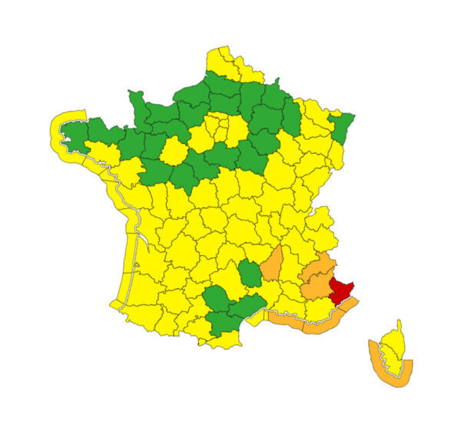
Credit: Météo France
Weekend sees the calm after the storm
Friday is the peak of the week’s poor weather, which began on Tuesday afternoon and has persisted since.
Weather warnings will remain in departments in the east and south-west, however only at a tier-two yellow level.
Rain will still hit parts of the country, particularly in the centre, however it will not fall heavily and be more akin to showers unlike what was experienced during this week’s storms.
Early predictions for Sunday are clear skies (except from scattered showers in the north), and slightly warmer-than-average temperatures, hovering between 15C and 20C for most of France.
Related articles:
Storms in France: what to do if at home, out walking or in car


