-
Two people and five properties struck by lightning in northern France
Violent storms hit amid ongoing heatwave
-
France’s Constitutional Council validates cap on bank inheritance fees
Charges on settling estates to be capped at 1% of deceased’s assets
-
Heatwave in France: 35 red alerts raised, Monday to be even hotter
Extreme temperatures forecast to last through the week
Flood warnings continue in south-west France and close to Paris
Alerts to remain in place despite temporary pause in rainfall
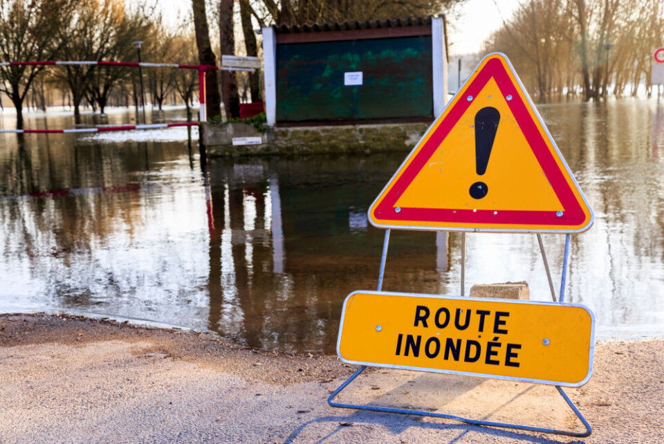
The number of departments facing heightened weather alert warnings has risen to seven this morning (February 27) after a night of heavy rain.
All but one of the warnings are for river flooding, although there is one tier-three orange alert in place for avalanches in the Pyrénées-Atlantiques.
The departments facing heightened river alert warnings are: Gironde, Charente, Charente-Maritime, Dordogne, Pas-de-Calais, and Seine-et-Marne.
The Drone and Isle rivers are at the highest risk of flooding in the south-west. The risk level of the Seine is currently tier-two, however a sub-tributary of the river, the Grand Morin, is at a heightened warning level.
Read more: What to do (and not do) during heavy rain and flood alerts in France
These warnings are currently in place until at least the end of Wednesday (February 28) despite a temporary pause in rain in most of the areas concerned.
In the north, calm weather should remain until Thursday. Sporadic rainfall is likely in the south-west.
The weather conditions are mainly being caused by a low-pressure wind, particularly in the south-west, although in Pas-de-Calais the effects are also partly due to last year’s floods.
Snow will fall at altitudes of around 1,000m above sea level – potentially lower – in the Pyrénées, however this is late for the ski resorts to fully benefit from.
In addition, it is part of the reason for the heightened avalanche warnings. At least four people died after an avalanche in central France on Sunday.
Read more: Lack of snow hangs over school holiday ski season in Pyrénées
Temperature drops
Temperatures are also set to drop across France, including in the south-west, where it may only reach 4C in Tarbes and Bordeaux.
North of the Loire, it may reach as cold as 2C or lower overnight, although daytime temperatures will be within February averages.
Rainfall will move east throughout the day, roughly hitting the Cévennes and areas between Montpellier and Lyon, although it is not expected to be heavy.
Alongside the departments on a heightened orange alert, more than half of France is on a tier-two yellow weather warning of some kind, mostly for river flood risks but also avalanches, wind, storms, heavy rain/flash flooding, icy road conditions, and strong waves.
You can keep up to date with official weather warnings through the official Météo France website, and river flood alerts via the Vigicrues website. Note that warning levels are likely to change frequently during severe weather events.
Related articles
How will weather be in my French town in 2050? New tool helps find out
Vehicles, homes: claiming compensation for weather damage in France


