-
Satellite photos reveal scale of recent wildfires in France
Before-and-after images show extent of damage
-
EasyJet cabin crew in France file strike notice
Unions act after failed talks with management
-
French railway carriage turned holiday home with its own tunnel for sale in Dordogne
‘Everyone knows me as someone who takes on projects, but this was really a bit crazy - buying a tunnel’
France braces for more storms with five areas facing flood alerts
Most of the country is under alert
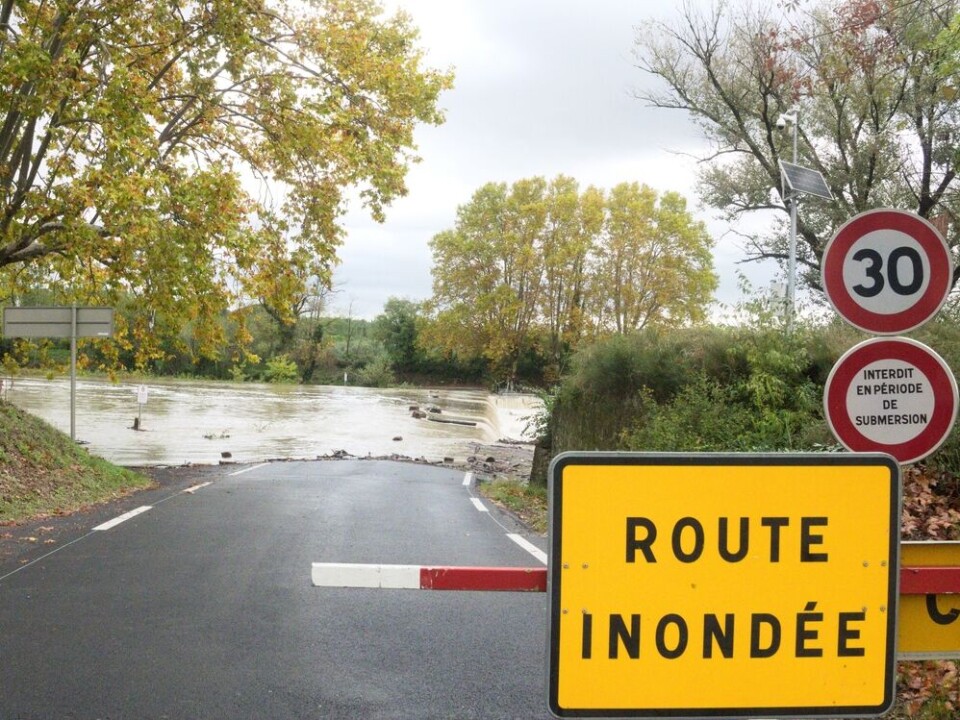
Storms are set to continue hitting France at the beginning of this week with the eastern half of the country bracing itself for heavy rains.
Around 40 departments are facing weather warnings today (October 23), ranging from the Spanish border in the south-west to the Vosges, close to the German border.
Five departments in the east are on tier-three orange alert for heavy rains and potential flash floods.
Most other warnings diminish this evening, but these five will remain in place overnight and potentially longer.
East to see heavy rain overnight
In the south and east, five departments – Jura, Isère, Ardèche, Drôme, and Ain – are facing tier-three warnings for heavy rain.
Storms originating in the centre-west of France near Limoges will make their way eastward throughout the day, causing warnings for stormy weather and high winds across most of the Massif central mountain range and France’s central departments.
Brief but intense rains will hit central departments in the early afternoon as the storms move east, and there is a chance of hailstorms close to Vichy in central France.
The storm will arrive in the east in the evening, before picking up in intensity around midnight – the photo below from Ventusky shows the intensity of rainfall at 23:00 on Monday.

The storm’s late arrival means the department will continue to face warnings on Tuesday morning, even as most other warnings across France diminish.
Read more: What to do (and not do) during heavy rain and flood alerts in France
Southern departments still on alert
Departments in the Mediterranean south are also on tier-two warnings for heavy rain, stormy weather, and strong winds.
Whilst not as powerful as last week’s storms, rainy conditions have persisted in the south, with most departments facing these warnings until Monday night. However, by Tuesday they will almost all be lifted.
In the south-west, strong winds across the Pyrénées mountain range are also causing warnings today.
You can see a map showing today’s warnings (accurate to 16:00) below.
Remember that some departments can face more than one warning simultaneously – you can keep up to date with warnings on the official Météo Francewebsite.
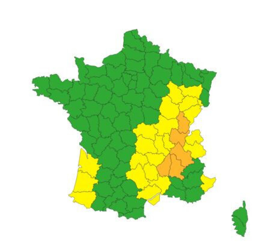
Credit: Météo France
You can see the damage from last week’s storms in the two articles below – one shows the effects of the storm in the Cévennes area, the other in the Alpes-Maritimes department.
Read also: SEE: Damage in south-east after storms lash coastal areas and inland
Read also: SEE: dramatic scenes of rising river water after heavy rain in France


