-
Normandy D-Day beaches gain UNESCO World Heritage status
Cathar castles also added as ‘Royal Fortresses of Languedoc’
-
Why one south-west France village is overrun by mosquitoes
'Several thousand larvae per square metre' in lake after flooding
-
Photos: Hail, floods and lightning after storms hit France
Violent thunderstorms on July 25 come after weeks of hot weather
France heatwave alerts multiply and to turn red, when will it end?
Red level alerts set to come into force Monday evening with a rise in temperatures forecast for midweek
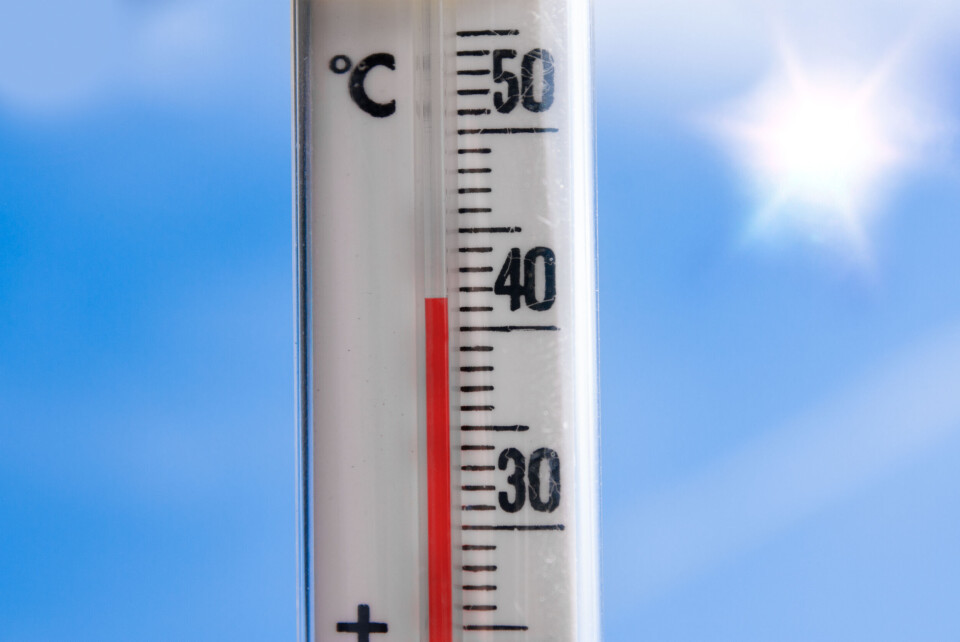
There is no sign of the August heatwave in France letting up in the next few days with temperatures set to stay above 40C this Monday (August 21) in many areas of the south.
Currently, 50 departments are facing tier-three orange warnings for a canicule (heatwave), but France's Ecological Minister Christophe Béchu said four departments would be elevated to a tier-four red level before the end of the day.
The departments in question are Rhône, Ardèche, Drôme, and Haute-Loire, according to the minister.
The warning level could be elevated in more departments across the south on Tuesday morning by Météo France, with departments such as Vaucluse and Gard also facing extremely high temperatures.
“The peak of the heatwave will be between Tuesday and Wednesday,” said the state weather forecasters, adding that “absolute highs” for temperatures in certain areas are likely to be broken tomorrow.
Private weather channel La Chaîne Météo said the current heatwave is the most intense in the south since 1947.
High of 42C could be seen on Monday
On Sunday, a high of 42.1C was recorded in the Isère department, and similar temperature levels could be reached again on Monday.
Both in the Rhône and Garonne valleys, La Chaîne Météo is predicting temperatures of more than 42C on Monday afternoon, due in part to a cloudless sky increasing the level of sunlight.
In Alés, a town of around 40,000 people in the Gard, temperatures could also reach 42C today.
Similar temperatures could be seen in major cities in the southern half of the country such as Grenoble (41C) Lyon, Avignon, and Nîmes (40C) and Toulouse (38C).
Although cities on the Mediterranean coast will not reach levels such as this, at 06:00 temperatures of 31.4C were recorded at Cap Béar (Pyrénées-Orientales) and 27C in Nice.
⚠️🌡 Fortes #chaleurs
— Météo-France (@meteofrance) August 20, 2023
Températures maxi attendues sur le pays pour les prochains jours ⬇️
🟠#vigilanceOrange #canicule
👉https://t.co/w5OGXbEEhP https://t.co/oVMm3IfbA7 pic.twitter.com/brWY7ZzE0v
Read more: France heatwave tips: How to sleep, keep cool and stay healthy
Alongside the 50 departments facing tier-three orange warnings this morning by Météo France, there are a further 14 facing tier-two yellow warnings.
You can see which departments are facing the warnings on the official Météo France website here.
Read more:How to keep your house cool in the high heat of the French summer
More than 1,500 calls have already been made to the free heatwave information number launched on Friday by the government.
Both Météo France and the Ministry of Health say it is highly likely on Tuesday that a number of departments will be placed on red heatwave alert.
The ministry states that temperatures “never registered before” are likely.
Exact predictions for Tuesday are not available yet, but temperatures of over 40C are expected in a number of departments in the south.
Read more: 9 French expressions to use when there is hot weather
How long will the heatwave last?
Temperatures on Tuesday and Wednesday will be the highest recorded during this heatwave with temperatures set to fall at the end of the week.
On Thursday, the end of the ‘heat dome’ which has been causing the temperatures will disperse quickly; thanks to a rush of cold air blowing in from the British Isles – this will see temperatures definitively fall in the south, and spell the end of the heatwave.
🌡️ La #vague_de_chaleur se poursuit ces prochains jours dans le sud et l'est de la France avec un pic entre lundi et mercredi. Jeudi et vendredi, un changement radical de temps est attendu. En effet, le #dôme_de_chaleur se repliera vers la Méditerranée, laissant la place à un… pic.twitter.com/E1aSiMpE0i
— La Chaîne Météo (@lachainemeteo) August 19, 2023
The cold snap could see temperatures in parts of the south plummet by 20C between Wednesday and Friday, with snow even potentially falling on the slopes of the Pyrénées mountains.
La Chaîne Météo insists however that changes of such “brutality” are rare and cannot be confirmed for sure for this week.
Related articles
Warmer summer? Météo France gives three-month weather trends outlook