-
Satellite photos reveal scale of recent wildfires in France
Before-and-after images show extent of damage
-
EasyJet cabin crew in France file strike notice
Unions act after failed talks with management
-
French railway carriage turned holiday home with its own tunnel for sale in Dordogne
‘Everyone knows me as someone who takes on projects, but this was really a bit crazy - buying a tunnel’
Heavy rain and flood alerts increase in southern France
Wind, flood, and storm warnings are also in place and the north-west is also facing storms
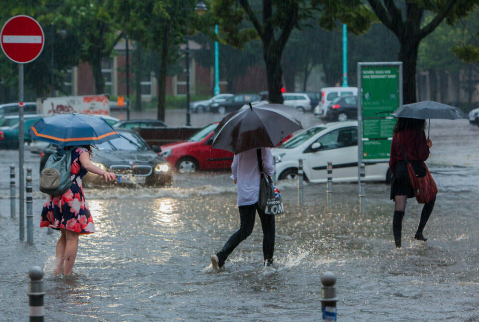
A number of departments in the south of France are on alert today (October 18) for a combination of storms, heavy rain, flooding, and strong winds.
The increased warning levels relate to an épisode cévenol, an intense autumnal storm in the Mediterranean and southern Massif central mountain range that began last night.
It means Ardèche and Drôme have joined Gard and Hérualt on a tier-three orange alert for heavy rain and flash flooding.
Elsewhere, there are weather warnings in Brittany and Normandy for strong winds and coastal flooding, as the north-west of France faces its own stormy conditions.
Storms pick up in strength
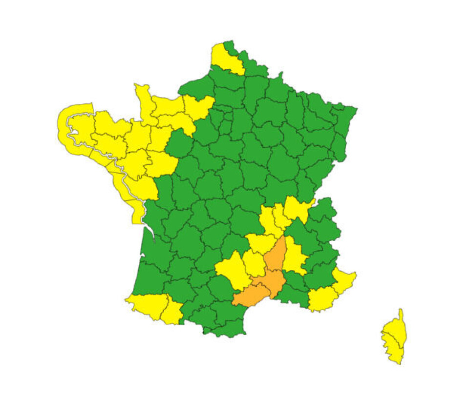
All in all, 30 departments have been issued weather warnings by Météo France this morning with most situated in the south and south-east.
Rainfall started on Tuesday evening in the south, but picked up in intensity overnight.
“The rain is intensifying on Wednesday morning… particularly over the hills and the first foothills of the Cévennes,” states Météo France in its daily bulletin.
“In places, the rain will not be very mobile, with intensities of up to 80 mm per hour, especially in the late afternoon and evening,” it adds.
Warnings in relation to the storms run as far north as Rhône (where Lyon is located) and Ain, which are both under a tier-two yellow caution for strong winds.
The Var, Alpes-Maritimes, and the two Corsican departments are also on tier-two alerts for stormy weather, and are also expected to be impacted by intense rainfall in the next few days.
Below is a screenshot of Méteo France’s current warnings. Be aware that some departments have multiple warnings simultaneously in place.
You can check these warnings on the official Météo Francewebsite here.
The cévenol storm is expected to last until at least Thursday evening in the western Mediterranean departments – although less intense rainfall could last until Friday evening – and possible into Saturday in areas close to the Italian border.
Currently, most departments in the south-east also have the same weather warnings in place for tomorrow (October 19) as well, although Météo France could increase the levels if the severity of stormy weather continues to increase.
The screenshot below shows the expected rainfall at 23:00 tonight in the south of France. You can click on the image to go to the Ventusky website and find real-time information about rain levels.

Read more: What to do (and not do) during heavy rain and flood alerts in France
Also warnings in north
Stormy conditions in the north have also led to a number of warnings, particularly in Brittany.
Tier-two warnings for coastal flooding are in place along the western Breton shoreline, and as far north as Eure and Pas-de-Calais there are alerts for strong winds.
Coastal winds could reach over 100 km/h by this afternoon in the north, states Météo France.
However, unlike the southern storms, the severity of the northern weather conditions will subside overnight, with no warnings currently issued there for Thursday.
Related articles:
Storms in France: what to do if at home, out walking or in car


