-
Neighbours take man to French court for playing same song over and over
Noise complaints are not uncommon in French towns and villages.
-
Where are the healthiest places to live in France?
New survey compares nearly 1,000 municipalities, west and south rank highest
-
Is the EU set to relax September’s strict EES implementation?
Nine countries, including France, have asked for greater flexibility
High wind warnings increased over storms in northern France
Two departments are now on the second-highest alert level with gusts of up to 130km/h forecast
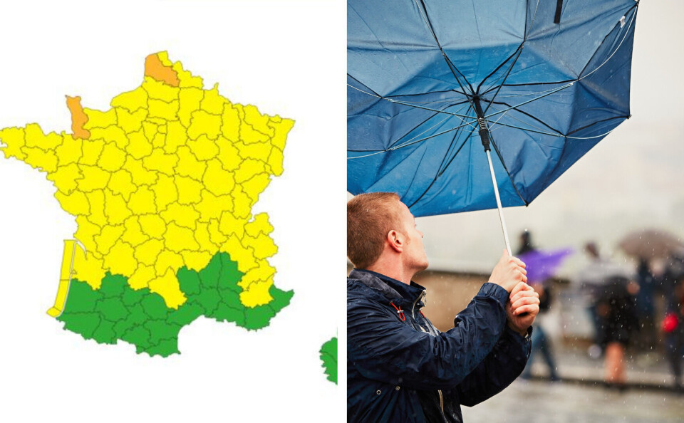
Parts of northern France could see gusts of up to 130km/h overnight on Friday (March 31) as storms sweep in.
Météo France has increased the alert level for two departments, Manche and Pas-de-Calais, putting them on the second-highest orange level, which advises locals to limit their movements and exercise extreme caution outside.
Two-thirds of France is on a lesser yellow warning - which advises residents to exercise caution and monitor weather updates - for high winds on Friday.
Northern France woke up to storms on Thursday and they are likely to persist well into Friday evening, with yellow warnings remaining in place.
It is a far cry from France’s south-west on Wednesday, where temperatures passed 30C and broke records for March.
You can keep up to date with further announcements on the France Météo vigilance page here.
Le fort coup de #vent est confirmé cette nuit et demain sur la moitié nord-ouest du pays. Voici, en animation, la chronologie et les rafales maximales prévues, sachant que sur les caps exposés (Ouessant, Cotentin...), des pointes à 130 km/h sont possibles. pic.twitter.com/cUBDm0BVlB
— La Chaîne Météo (@lachainemeteo) March 30, 2023
Related articles
Watch: Villagers record ‘almost apocalyptic tornado’ in central France


