-
Surprise train strike to hit Normandy this weekend
Close to 40% of trains to destinations such as Evreux, Caen, and Rouen cancelled on Friday
-
French farmers clash with prefecture over help for firefighters
Farmers hurry to deliver water and supplies, but authorities say they must use official channels
-
World’s largest Celtic festival begins this weekend in Brittany
The 55th edition of France’s huge ‘Interceltic’ celebration is dedicated to Cornwall and the Celtic Sea
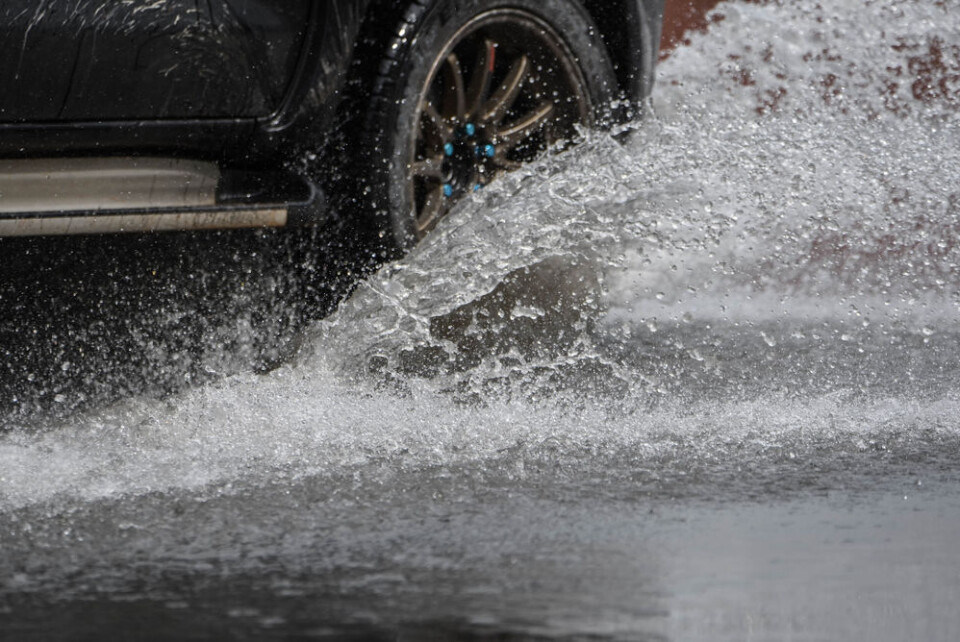
Roads closed as flood alerts remain in south-west France
Warnings are expected to continue over weekend with rains returning tomorrow
[UPDATE February 28 at 16:30: All tier-three orange weather alerts were lifted earlier this afternoon by Météo France.]
Heightened river flood alerts were in place in six departments today (February 28), as the repercussions from heavy rain at the start of the week continue.
Several departmental roads in the south-west have been temporarily closed, with river levels far above normal.
Pas-de-Calais, Seine-et-Marne, Dordogne, Gironde, Charente, and Charente-Maritime were facing tier-three orange warnings for river flooding until 16:00.
In addition, an orange tier avalanche warning is in place in the Pyrénées-Atlantiques department, although this is scheduled to be lifted before midday.
Read more: What to do (and not do) during heavy rain and flood alerts in France
The areas facing flood warnings are expected to stay free from rain for most of the day, but rain is set to return by Thursday (February 29) evening at the latest.
In Corsica, which has so far been untouched by the recent severe weather warnings, up to 60mm of rain has fallen in the mountainous areas since the weekend, equivalent to almost three weeks of rain on the island.
Elsewhere, along the English Channel, the commune of Côte de Nacre, Calvados has seen a number of streets flooded with seawater due to powerful waves and gales of over 100 km/h. You can see photos on the French media outlet site Actu here.
River levels remain high, drivers affected
Despite a temporary pause in rain, departments are still on a heightened alert for flooding due to river levels remaining high.
Along some parts of the Isle river in the south-west, water levels are currently more than 3m higher than average, less than one metre from the all-time record set in January 1962.
The levels will drop gradually throughout today and tomorrow morning, although they will not return to normal before the next bout of rainfall starts at the weekend.
In the Dordogne, some roads in the west of the department have been temporarily closed, including the D3, D4, and D3E4.
Yesterday, a number of other roads were closed across the entire department, although these have now reopened.
Other departments in the south-west, including in Gers and Gironde, are still facing some road closures.
You can check the status of local roads on departmental websites, with updates on closures usually given after midday.
Read more: Vehicles, homes: claiming compensation for weather damage in France
Will warnings remain for rest of the week?
The six flood alert warnings are set to remain in place until at least Thursday, the latest information currently available from Météo France.
It is likely they will continue over the weekend as a fresh bout of rain and stormy weather is predicted, causing river levels to rise once more.
Tier-two yellow warnings will also remain in place at similar levels to today. Currently, more than half of all departments have at least one warning in place.
You can keep up to date with all official weather warnings via the Météo France website, and all river flooding information via the Vigicrues website.
Note that warnings are likely to change frequently during periods of intense weather.
Related articles
How will weather be in my French town in 2050? New tool helps find out
Storms in France: what to do if at home, out walking or in car


