Storm Pierrick hits France in week of alternating cold and warm spells
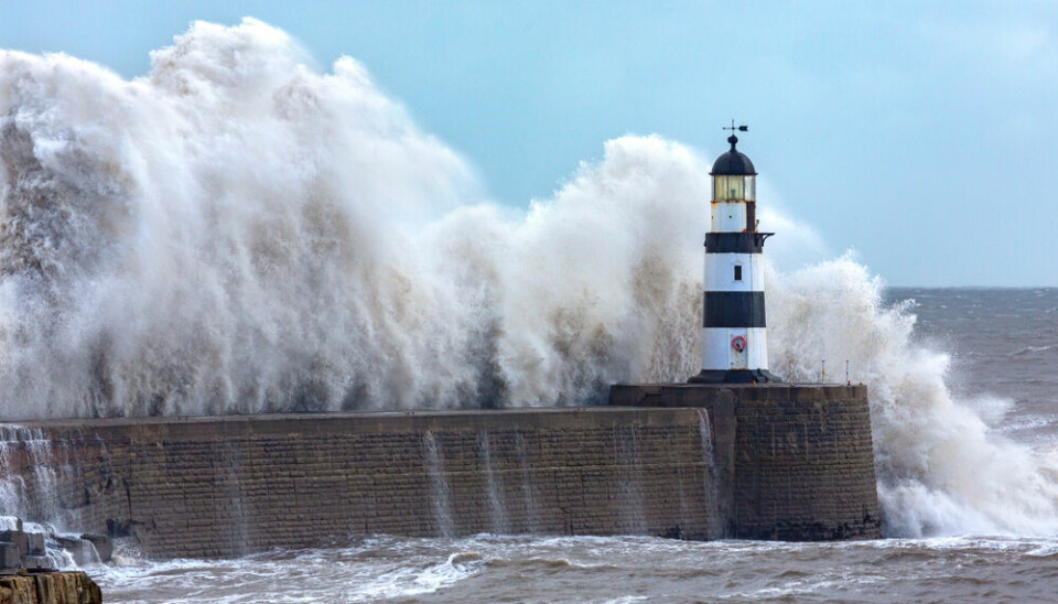
Several departments are facing alerts with gales of up to 130km/h expected in Brittany
Temperatures across France are set to fall then rise and then fall again over the coming days as a period of unstable weather replaces the weekend’s record-breaking heat.
Storm Pierrick will hit the west of France, particularly Brittany, this morning (April 8) before moving eastwards over south-western and central areas at night. An offshoot of the storm will also hit Normandy.
Gales of 130 km/h are expected in Finistère this morning. A heightened orange weather alert has been issued for strong winds and coastal waves.
There are heightened orange warnings for river flooding in five departments: Eure, Seine-Maritime, Gironde, Charente-Maritime, and Pyrénées-Atlantiques.
⚠️Prudence en raison des #orages⚡️qui vont d'abord concerner lundi après-midi le nord-ouest du pays. Puis le soir, c'est entre les #Pyrénées et les #Ardennes que les orages s'annoncent les plus forts, accompagnés de soudaines et brutales rafales. pic.twitter.com/Vvcx0SukQc
— La Chaîne Météo (@lachainemeteo) April 7, 2024
Several other departments are facing tier-two yellow alerts for stormy weather, but these may be heightened if the storm worsens throughout the day, with storm Pierrick bringing heavy rain and potentially hail to central areas.
Temperatures fall after record breaking weekend
Temperatures in the affected areas will drop significantly – reaching no higher than 16C in Brittany – although in the east and Mediterranean, highs of 27C are still expected.
Last weekend saw abnormally warm temperatures across almost all of France, with a high of 33.7C in Navarrenx (Pyrénées-Atlantiques).
Pau, also in the Pyrénées-Atlantiques, saw a high of 32C, over one degree higher than the previous April record.
Records were also broken in Vic-en-Bigorre and Campistrous (Hautes-Pyrénées) with temperatures almost 2C higher than previous records.
Read more: What is predicted for the weather this spring in France?
The national average temperature in France at the weekend was 17.6C, more than six degrees higher than usual for this time of year, and over half a degree hotter than the previous record for the beginning of April (set in 2015).
Today it is still almost six degrees warmer than average but the arrival of storm Pierrick and the subsequent cold weather will drop the national average temperature below seasonal norms for the first half of the week.
Temperatures are then set to rise again from Thursday (April 12) onwards, particularly in the south, with the average temperature rising around five to six degrees higher than April norms once more.
A mini ‘cold snap’ is forecast for the beginning of next week, with the national average temperature expected to drop more than 3C below seasonal averages, and remain low until the following weekend (April 20).
You can keep up with all weather warnings related to storm Pierrick on the official Météo France website. Note these are subject to change multiple times during periods of intense weather.


