-
Why you may see black bags on trees across forests and towns in France
Colour and location of bags provide hint for their purpose – and you should steer clear of black bags
-
Ryanair rules out summer flight cancellations due to fuel issues
Fares are dropping due to lower demand - but are likely to increase later
-
Highs of 36C in south-west France expected this week - then a big drop
Revised conditions point towards dramatic rise and fall of around 15C
Drought map update: 19 French departments have crisis-level alerts
Central and western areas are most severely affected by water restrictions but southeastern areas are also under strain
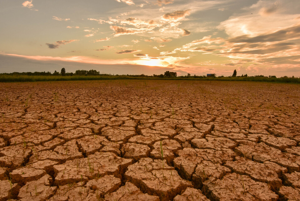
France’s official data concerning where drought warnings and/or alerts and thus water restrictions for residents are in place was last updated yesterday (July 12).
The new map of water restrictions from the official Propluvia website shows that the alert level has been heightened in western departments such as Loire-Atlantique and further inland towards Loir-et-Cher.
Hautes-Alpes, which had no restrictions applied to it last week according to Propluvia, is now covered by an alerte and an alerte renforcée. The difference between these restriction levels is explained below.
In contrast, a few departments – including Allier and Puy-de-Dôme – are showing as having had their alerts removed.
When drought alerts are in place in a department, the level of restriction can vary depending on the commune – we cannot show the variations exactly as they occur and advise checking on the Propluvia website or with your mairie.
This map shows the departments where drought warnings or restrictions are in place at the moment, with grey departments not under any type of alert, and the others classed from light to dark red according to the severity of the situation.
You can compare this map to last week’s here.
Our additional maps below also reflect area variations in greater detail.
You can search for your department in the top left-hand corner.
1. Departments under vigilance warnings
‘Vigilance’ (‘warning’) is the lowest level of drought restriction in France and involves raising awareness and encouraging individuals to reduce their water usage.
The map below reflects the departments which are largely or completely covered by a vigilance warning.
You can find out further information about your commune on the government’s Propluvia drought alert website.
2. Departments under alerte-level restrictions
Water restrictions begin to be imposed from ‘alert’ (‘alerte’) level, which imposes limits on the amount of water which can be used for farming and for watering green spaces such as golf courses.
Residents will be required to reduce the amount of water they use to fill swimming pools, wash cars and water their garden among other actions.
Farmers will have to reduce their water usage by up to 50% (or stop using it for up to three days a week).
The map below reflects the departments in which there are alertes are in place, although the restrictions will not necessarily cover the whole area. Further details can be found on Propluvia.
3. Departments under alerte renforcée-level restrictions
The next level of restrictions is ‘reinforced alert’ (‘alerte renforcée’), which tightens the above limitations and could also lead to some usages being temporarily banned.
Farmers must reduce their water usage by at least 50% or stop using it for 3.5 days each week.
The map below reflects the French departments in which there is at least one reinforced alert in place, perhaps in conjunction with lower level alerts.
4. Departments under crise-level restrictions
The final restriction level is ‘crisis’ (‘crise’), under which water may only be used for essential reasons such as drinking, cooking or washing.
Below is a map showing the departments where some areas are under crisis-level restrictions.
This information is correct as of July 13, 2022.
Related articles
Thousands evacuated as wildfires rage in southwestern France
France prepares for 10-day heatwave, wildfire risk increases
France’s official average temperature rises by 0.4C after review


