-
French heatwave update July 7: 61 departments on heightened alert
Water use is above average and hospitals are preparing for a rise in heat-related symptoms
-
France’s heatwaves light up transatlantic debate on AC
This year has seen temperatures rising over 40C
-
Ryanair urges France to reform air traffic control after Senate warning
Official report warns that France may struggle to handle growing air traffic
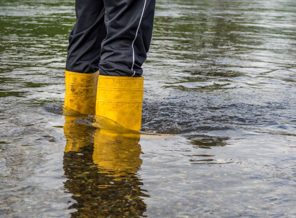
Floods and storms: much of France facing weather alerts
West and south-west particularly affected with heightened warnings. Warm weather, however, is set to continue
[Update 12/12 at 16:00: the Ain department has also been placed on a heightened warning for river flooding]
The continuous rainfall across much of France shows little sign of letting up today (December 12), with ten departments being placed on heightened weather warnings.
All ten departments facing tier-three orange warnings have alerts in place for river flooding, with some also facing warnings over heavy rain.
The departments facing these warnings are situated mostly in the west and south-west although some are in the Alpine east.
Both areas were hit hard by rainfall yesterday, which – despite decreasing in intensity in the south-west – has persisted overnight, leading to an increase in river levels across several sections of major waterways.
Elsewhere, more than half of mainland French departments are facing tier-two yellow warnings, for flooding, stormy weather and avalanches.
Despite these warnings, the country is still set to experience mild temperatures for the season – as high as 15C north of the Seine, and up to 20C along the Mediterranean coastline.
Temperatures will fall slightly tomorrow (December 13) but will still be around 4C warmer than December averages.
However, frosty winds are set to bring temperatures down to colder than average levels from Thursday (December 14) onwards.
Multiple rivers affected
As of 09:00 today, the ten departments facing heightened alerts for river flooding are:
- Gironde
- Charente-Maritime
- Charente
- Vendée
- Dordogne
- Corrèze
- Lot
- Isère
- Savoie
- Haute-Savoie
These final two are also facing heightened alerts for heavy rain/flash flooding.
During the morning, rain will fall in the Alpine areas and north of the Nouvelle-Aquitaine region, where warnings are in place, as well as in the north.
Progressively throughout the day, rainfall will pick up in Brittany and Normandy, which may lead to stormy conditions in the afternoon and evening, particularly around the coast.
The post below on X (formerly Twitter) shows exactly how many waterways in France are currently facing warnings over high levels:
Passage en #vigilanceorange de la #Dronne amont (dpt #Dordogne), #Charente amont et #Tardoire (dpt #Charente). Maintien sur les autres cours d'eau. Restez informés sur https://t.co/wS98gcDiHD pic.twitter.com/hEAi8PZB5R
— Vigicrues (@Vigicrues) December 12, 2023
You can find an exact list of the rivers facing warnings – alongside which specific stretches of the river the alerts pertain to – on the official Vigicrues website.
In addition, you can check the official Météo Francewebsite to keep up to date with weather reports.
It is likely that warnings will change throughout the course of the day, as the level of rain continues.
Related articles
What to do (and not do) during heavy rain and flood alerts in France


