






news
France adopts new world map, moving on from Mercator
UN backs drive to more accurately reflect the size of continents


France has changed the world map used by its foreign ministry after the UN backed efforts to make maps more accurately reflect the size of continents.
France has abandoned the Mercator projection for its official diplomatic maps, adopting the Eckert IV projection instead.
The move came on Friday, September 4, as the UN General Assembly adopted a resolution encouraging governments, schools, international organisations and technology companies to use maps that more accurately represent the relative size of territories.
The resolution, backed by France and led by Togo and the African Union, is not legally binding, nor does it call for Mercator to be banned, meaning the projection will continue to be used where its particular properties are useful.
Why Mercator distorts the world
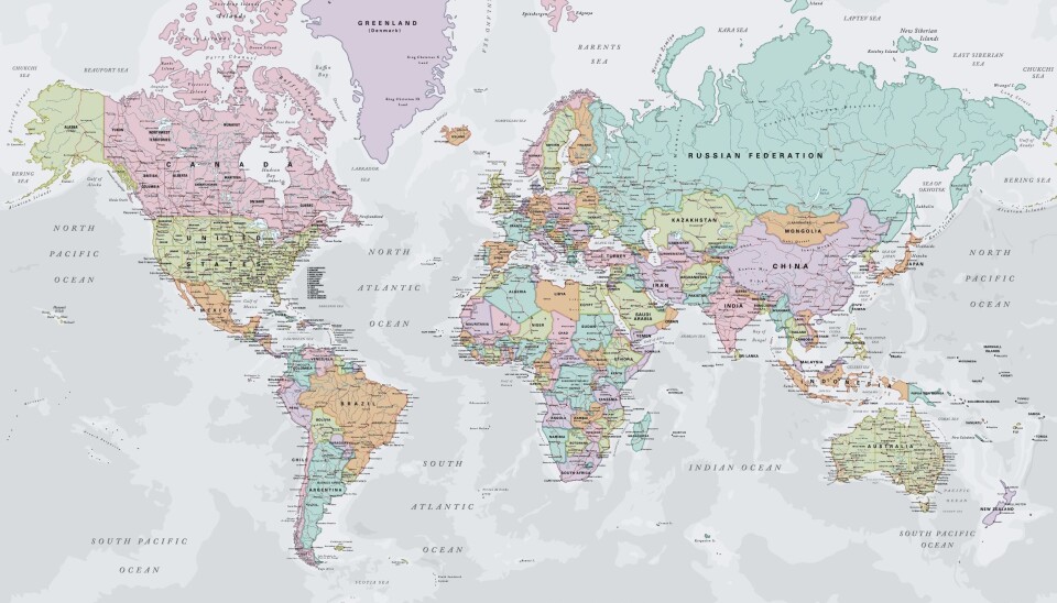
Created by Flemish cartographer Gerardus Mercator in 1569, the projection was designed primarily for maritime navigation. It preserves angles, allowing sailors to plot courses using straight lines.
However, it exaggerates the size of territories towards the poles. Greenland, for example, appears almost as large as Africa on a Mercator map, despite Africa being about 14 times larger in reality.
The effect also makes Europe, Russia, Canada and the United States appear larger relative to countries in Africa, Latin America and South Asia.
No flat map can represent a spherical Earth without some distortion of area, shape, distance or direction.
The issue is therefore not that Mercator is technically incorrect, but that a projection designed for navigation can give a misleading impression when used to compare the size of countries and continents.
France's new Eckert IV projection is an equal-area map that represents territories in proportions closer to their actual size. It is similar in principle to the Equal Earth projection, which has also been promoted as an alternative to Mercator.
France looks smaller
The UN resolution was promoted by African countries as part of a wider campaign over how the continent is represented.
Togo's foreign minister, Robert Dussey, told the UN that maps were not simply geographical tools but helped shape people's understanding of the world.
French Foreign Minister Jean-Noël Barrot similarly argued that distorted representations could influence perceptions.
“Our diplomacy must carry our own narrative and always ensure that we represent the world accurately,” he said.
The change means France itself will appear smaller on its official maps, as will other countries and regions whose size is exaggerated by Mercator.
The French government said the decision reflected a desire to represent the world more accurately, while the UN vote gives further international backing to the use of alternative projections.


