-
Normandy D-Day beaches gain UNESCO World Heritage status
Cathar castles also added as ‘Royal Fortresses of Languedoc’
-
Why one south-west France village is overrun by mosquitoes
'Several thousand larvae per square metre' in lake after flooding
-
Photos: Hail, floods and lightning after storms hit France
Violent thunderstorms on July 25 come after weeks of hot weather
France hot spell: what is the outlook on how long it will last
Most aread of country affected with temperatures only dropping after storms
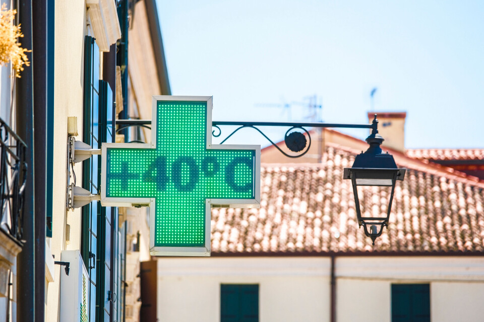
Exceptionally high temperatures were once again recorded in France yesterday, with there being seemingly no let up to the warm weather in much of the country.
Predicted to be the hottest week of the year in France, temperatures are expected to climb even higher before the weekend.
Official weather site Météo France predicts that the warm weather will drag on into next week, and only disperse after intense storms that will appear next Tuesday (August 22).
The warm weather could last until the end of next week however, with temperatures only dropping once the storms have dispersed.
All areas of the country will see high temperatures at the end of this week, with the exception of Brittany and Normandy.
Temperatures outside of these two regions are expected to hit 30C, and could even reach 40C in the Mediterranean and Rhône Valley areas.
The latter area is still facing tier-three orange warnings over heatwave conditions, which are present in five departments until at least Friday August 18.
Storm warnings are also currently in place in 50 departments across France, ranging from the Pays Basque near Spain all the way to the Rhine.
Hail is also predicted during today’s storms, especially near Tarbes in the south west and Dijon in the east.
South will remain hotter than north
With the exception of Brittany and Normandy, the entirety of mainland France and Corsica will be hit with significant hot weather until at least next Monday (August 21).
At least 80% of the country will see temperatures over 30c during the day between this Friday (August 18) and Sunday (August 20).
After this date, temperatures will drop slightly in the north, but could still reach 33C in Paris and even 31C in Lille at the beginning of next week
In the south, temperatures will remain at their current levels, reaching close to 40C in the Rhône Valley and 38C in the south west.
Next Tuesday (August 22) will see storms roll in from the Atlantic and cover much of western France, before rolling eastwards Wednesday and hitting departments on the Swiss and German borders.
Almost all of France will be hit by the “violent storms” predicted by Météo France, save for the Mediterranean coastline.
During the storm, temperatures could remain at their current levels, and only drop back to summer averages once the storms have passed next Friday (August 25).
Read more: This week is set to be hottest of year in France: How hot and where?
Current storms have no impact on heatwave
Over half of the country is currently facing level two storm warnings, thanks to a storm spreading eastwards from the Atlantic coast to the Rhine river.
These storms could see hail alongside heavy rainfall.
Tomorrow (August 17) sees the number of departments facing storm warnings drop slightly to 43, although this includes departments in the south west and east, as the storm is expected to persist until late on Thursday night.
Some departments are facing both storm and heatwave warnings, with rainfall having a minimal cooling effect on temperatures in the east of France around Lyon.
You can keep track of weather warnings by checking the official Météo France ‘vigilance’ page here.
Related articles:
France heatwave tips: How to sleep, keep cool and stay healthy
‘Face the reality’: France ‘must prepare’ for +4C global warming