-
French minister calls on airlines to ‘respect passenger rights’
Transport minister’s appeal comes as airlines add charges and cancel flights amid jet fuel crisis
-
Man sent to prison over Linky fraud, a first in France
He also offered illegal meter modification services online
-
Why people in Nantes are being asked to ‘plant their underwear’
A total of 29 pairs of cotton underwear will be buried across 19 different sites
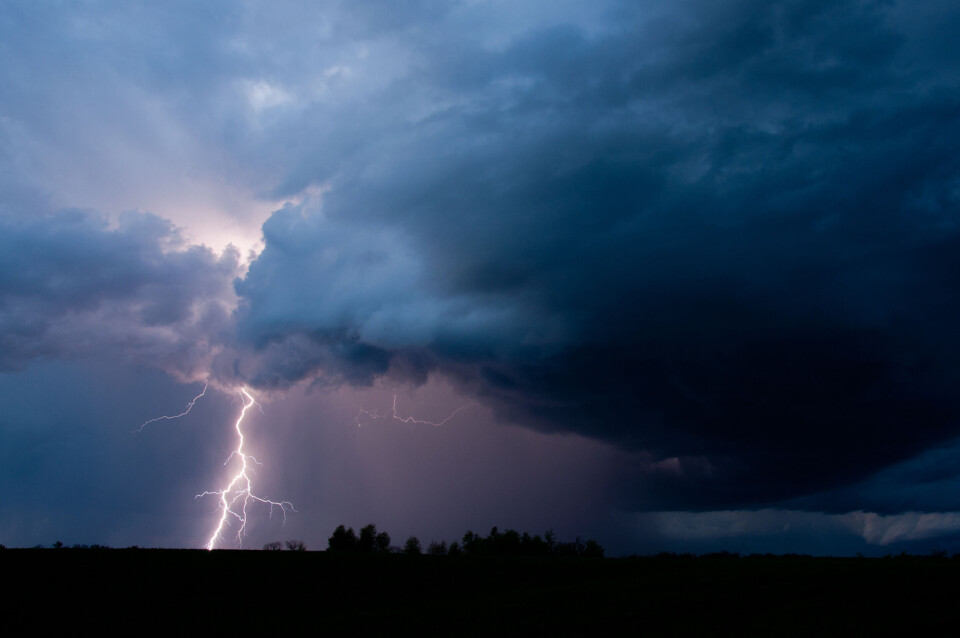
Northern France on storm alert, risk of violent winds
12 departments in Ile-de-France and the surrounding areas are under an orange warning. Up to 40mms of rain expected in some areas
[Update September 5 at 16:15 - Hérault and Gard were also placed under an orange weather alert in Météo France's 16:00 update.]
Some 12 departments in northern France have been placed under an orange storm alert this afternoon (September 5).
The departments are: Cher, Loiret, Oise, Aisne and all those in Ile-de-France.
National forecaster Météo France has warned that the storm will begin in Centre-Val de Loire and then climb towards Ile-de-France and Hauts-de-France.
It will bring wind gusts of up to 110km/h, 10-20mm of rain – and up to 40mm in some places – hail and lightning.
🔶 12 dpts en #vigilanceOrange
— VigiMétéoFrance (@VigiMeteoFrance) September 5, 2022
Restez informés sur https://t.co/rJ24zzmmy4 pic.twitter.com/QahE5VCEE9
The orange warning should come to an end at around 22:00 this evening.
A further 62 departments are under a yellow storm alert.
You can find out more on the Météo France website.
Related articles
What’s coming up? The week ahead in France
French drought causes early – and poor – apple harvest in Brittany