-
Eating unpasteurised cheeses can lead to longer, healthier life, French study finds
Raw-milk cheeses found to reduce inflammation
-
Two hantavirus contact cases in isolation at Bordeaux hospital
Authorities hopeful that virus has not mutated, easing pandemic fears
-
Speed cameras: French mayors can soon install more
Mayors will have the authority to do so…but at their commune’s own expense
Five French departments on heatwave alert as high temperatures return
How hot is it expected to be and for how long?

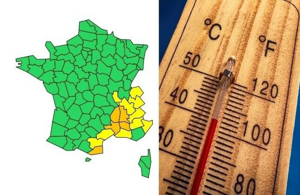
Five departments in southern and southeastern France have been placed under an orange-level weather warning for heat today as Météo France warns of several days of very high temperatures.
Read more: Another hot spell heads for France: what to expect this week
The departments are: Pyrénées-Orientales, Ardèche, Drôme, Gard and Vaucluse, and 10 further departments surrounding them are also under yellow canicule warnings.
🔶 5 dpts en #vigilanceOrange
— VigiMétéoFrance (@VigiMeteoFrance) July 31, 2022
Restez informés sur https://t.co/rJ24zzmmy4 pic.twitter.com/p5GYFlJrRv
Last night (July 31), it was cool over the Languedoc-Roussillon and Rhône valley, but at 05:00 it was 27.2C in Perpignan, 24.6C in Nîmes-Courbessac and 25.5C in Avignon.
Temperatures are expected to rise throughout today and tomorrow, reaching 35-38C in the areas under an orange alert and 39C in some areas of Gard.
In the northern half of the country, temperatures should be in the region of 30-34C, apart from in Brittany and around the Channel, where they are expected to remain below 30C.
The peak of the heat is set to arrive on Wednesday (August 3), with highs of 39-40C in the south west.
Les #FortesChaleurs reviennent dès demain. Les températures grimpent d'abord dans le sud-est lundi avant de gagner vers le sud-ouest mardi et le nord mercredi, jour du #PicDeChaleur attendu à l'échelle nationale. Suivez la situation sur https://t.co/CSYEovTI83 pic.twitter.com/pA7aShl1sv
— VigiMétéoFrance (@VigiMeteoFrance) July 31, 2022
“The anticyclone from the Azores, responsible for the July heatwave, is returning to France,” Météo France forecaster Jean-Yves Choplin has said.
“In the north of the country, the episode should be short, with the return of ‘fresher’ air from the north west on Thursday and Friday. In the south, the hot air will linger for longer, especially in the south east.”
However, nowhere in France should remain under the high temperatures for as long as parts of the south west and south east did in July.
Météo France has warned of a “very high risk of fires” along the Mediterranean coastline, because of the appearance of “quite strong” mistral and tramontane winds and “conditions remaining very hot and dry across vegetation growing more and more fragile”.
To limit the risk of wildfires, all of Vaucluse’s forests – and several of Bouches-du-Rhône’s – have been closed to the public
France has already seen two heatwaves this year, in June and July, the latter being the third most intense and fifth longest since 1947.
Related articles
Video: A ‘dust devil’ mini-tornado hits wheat field in western France
Ten million homes in France risk structural cracks after heatwaves
Volunteer firefighter arrested for Hérault fires: What we know so far


