-
Stepmother convicted in France for slapping boy, 5
It has been illegal to smack children since 2019
-
France economy minister says ‘a little more time’ needed for fuel prices to drop to €1.70
Fuel prices ease in France as tensions cool, with more declines expected gradually
-
Worst traffic days in France revealed for summer 2026
Bison Futé predicts ‘extremely difficult conditions’ during peak holiday periods
Alerts for heavy rain: forecasts worsen across France
An ‘atmospheric river’ from the Caribbean is set to bring wet and windy weather

The spell of warm weather is coming to an end as a weather phenomenon known as an ‘atmospheric river’ is set to arrive from the Caribbean bringing rain and strong gales.
Around a third of departments have been placed on alert with areas across France affected.
The weather is set to worsen from February 8 as the wet weather arrives. Gales will begin to buffet the Atlantic coast from the afternoon, reaching up to 75km/h in Brittany and continuing over the weekend.
The rain is forecast to be moderate in the northern half of France on February 8 and 9, however the south and south-east will see heavy rain from February 9 over Provence-Alpes-Côte d'Azur and the Cévennes in particular.
Dozens of departments are on alert
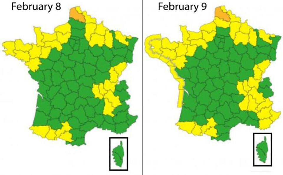
The river Canche near the village of Brimeux in Pas-de-Calais has burst its banks after between 20mm and 40mm of rain fell on the department in 24 hours. Météo-France has placed the department on high (orange) alert and much of the north-east on (yellow) alert due to local flooding.
Read more: Natural disaster declared in hundreds of communes in north of France
From February 9, 37 departments will be on (yellow) alert due to high winds, particularly on the Atlantic coast. There is a danger of avalanches in the Alps.
The south-east will see particularly heavy rain, which may cause local flooding in:
- Hautes-Alpes
- Var
- Alpes-de-Haute-Provence
- Alpes-Maritimes
The heavy rain, which is likely to intensify until Sunday, may also cause water courses to flood in Ardèche.
An ‘atmospheric river’
The atmospheric event that brings a corridor of wet weather from the Caribbean is known in France as the ‘Rum Express’. A similar phenomenon that strikes California is known there as the ‘Pineapple Express’.
“The phenomenon is due to successive depressions over the Atlantic, which rotate simultaneously, acting like pumps, to send hot and wet air north,” states Météo-France.
“There remains some uncertainty concerning which areas will be affected by the phenomenon and how intense it will be.
“For the time being, the forecast largely remains on (yellow) alert for rain and flooding but at this stage we cannot exclude the possibility of raising the alert level.”
Read more:
Lack of snow hangs over school holiday ski season in Pyrénées


