-
Retiree in south-west France shoots down mairie drone, mistaking it for burglars
Locals were not warned that the drone was being used to check roof of village hall
-
Map compares price of motorbike insurance across regions of France
The average premium is now €634, marking a 6% increase compared to last year
-
Cat owner in France must pay neighbour €100 after pet enters property
The neighbour had been claiming several thousands euros
Large areas of France placed on alert over storms and strong winds
Northern France and eastern parts of the country are set to be worst affected

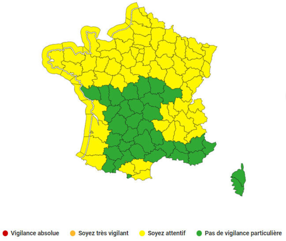
Dozens of French departments have been placed on alert for strong winds and storms on Friday (March 24).
La #météo de votre vendredi sera très agitée, surtout l'après-midi au nord-ouest : avec une forte instabilité, des averses et #orages se formeront. Ils s'accompagneront localement d'averses de #grêle et de fortes rafales de vent ⚡️⛈️ (Carte : risque d'orage en %) pic.twitter.com/9oJ3mn0GXn
— La Chaîne Météo (@lachainemeteo) March 23, 2023
Météo France said storms are expected to last throughout the day and into Saturday morning.
It is issued a yellow warning, which is the third-highest alert level and means to be vigilant.
The forecaster added that "the rain will be more continuous and temporarily moderate from the morning over Brittany and then over the North and North-West in the afternoon. In the east, it will remain light during the day”.
Near the English Channel and over Brittany, a fairly strong south-westerly wind, with gusts reaching 70 to 90km/h.

Despite spring officially starting this week, the hour change on Saturday night (March 25) is to be greeted with winterly weather with more strong winds and rain with even some snow expected in the Pyrenees area, according to lachainemétéo.
Read also
France allows local authorities to use wastewater after record drought


