-
Neighbours take man to French court for playing same song over and over
Noise complaints are not uncommon in French towns and villages.
-
Where are the healthiest places to live in France?
New survey compares nearly 1,000 municipalities, west and south rank highest
-
Is the EU set to relax September’s strict EES implementation?
Nine countries, including France, have asked for greater flexibility
Most of northern France is on alert for storms and high winds
Gusts of up to 120km/h are being forecast in some areas
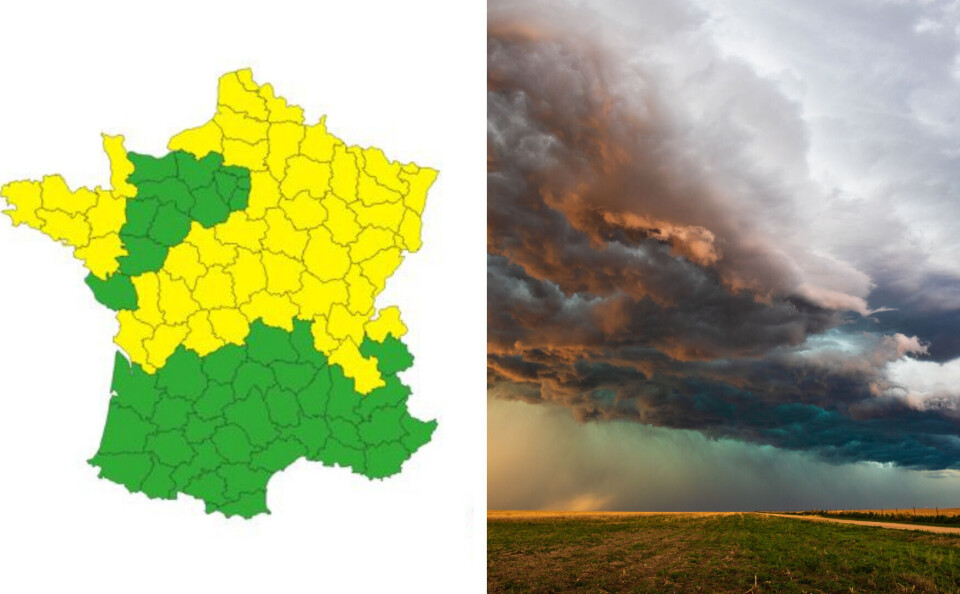
Most of northern France is bracing itself for storms and high winds.
Météo France has issued a yellow alert (the third-highest possible) for stormy conditions in more than 40 departments.
It mainly affects France’s north and north-east but also includes some departments in Brittany and Nouvelle-Aquitaine.
Western and central departments are on alert from late on Wednesday (March 29) evening, with the north and north-east expected to be hit on Thursday.
The departments of Isère and Haute-Savoie are forecast to be on yellow alert for avalanche risks on Thursday.
La Chaîne Météo says Friday (March 31) could be worse, with 120km/h gusts expected in north and north-west France.
Le fort coup de #vent se confirme pour la nuit de jeudi à vendredi, ainsi que vendredi toute la journée. Voici les rafales max attendues sur l'épisode. Des rafales à 120 km/h seront possibles sur la pointe bretonne et les caps exposés. pic.twitter.com/NAoB5FiSzm
— La Chaîne Météo (@lachainemeteo) March 29, 2023
The storms and high winds are in stark contrast to Wednesday’s weather in France’s south-west, which saw temperatures in the high 20s, threatening records.
Read also: Erratic weather as France's south-west set to go from frost to 28°C
You can keep up to date with any changes to Thursday’s weather on Météo France’s website here.
Yellow-weather warnings are the third-highest given, asking people to exercise caution when outside and keep informed of local weather changes.


