






-
French weekly weather forecast October 26 - 30: warm few days before a drop
Rain limited to coastlines at start and end of week
-
Storm Austen aftermath: falling tree damages three homes as new rain alert issued in France
How to prepare before a storm and what to do if a tree falls on your home
-
Blackouts, ferry disruption and fallen trees as Storm Austen hits France
Northern and western France on alert as gales reach up to 160km/h
Nearly all of France on alert for strong winds
Gusts could reach up to 100 km/h and coastal departments have been warned over flooding from the sea
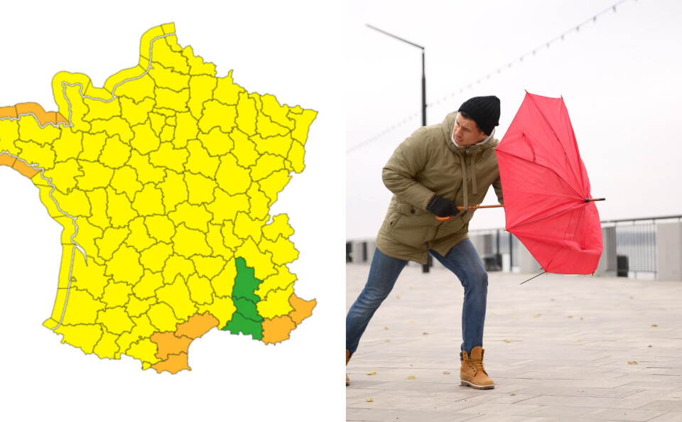
[Update 09/03 16:45 to reflect an update from Météo France. Eleven departments have now been placed under orange alert (be very vigilant) for tomorrow (Friday March 10)]
- Orange alert for high winds: Pyrénées-Orientales, Aude, Hérault, Var, Alpes-Maritimes, Haute-Corse and Corse-du-Sud.
- Orange alert for flooding/high waves: Finistère, Côtes D'Armor, Ille-et-Vilaine and Morbihan.
- The department of Ain has been moved from no alert (green) to yellow alert (be vigilant)
🔶 11 départements en Orange pic.twitter.com/aRqpJlGgfD
— VigiMétéoFrance (@VigiMeteoFrance) March 9, 2023
Nearly the whole of France is on alert for strong winds on Friday.
Gusts were already reaching up to 70km/h in some parts of the country on Thursday but by Friday may reach up to 100km/h in coastal areas around Brittany and west of the English Channel.
The high winds have prompted Meteo France to issue a yellow weather warning for the entire country except a handful of departments in the south-east. There is also an alert for flooding along France’s Atlantic and Channel coasts.
Yellow warnings are the third highest level of alert and ask people to practise caution and stay up to date with weather developments in their area.
Over half the country already on alert
Today (March 9) sees more than 50 departments in France already facing yellow weather warnings, mostly for strong winds and avalanches, as well as for thunderstorms in the central and south-western parts of the country.
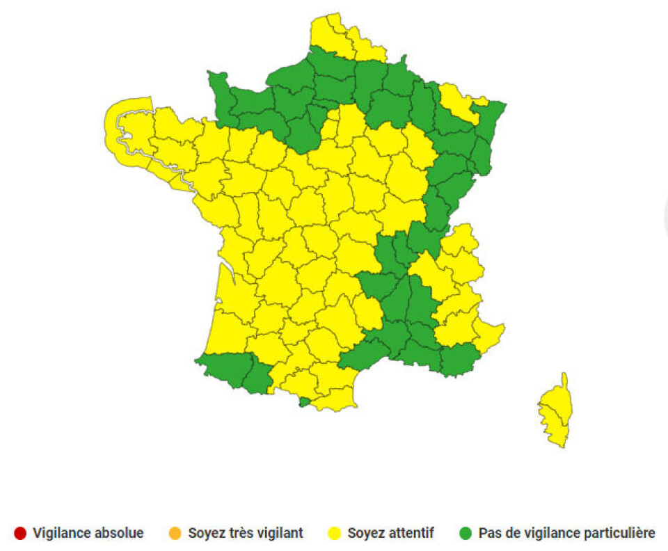
These warnings are set to take place from the early afternoon - wind warnings start at 3pm, and thunderstorm warnings slightly earlier at 2pm.
Lingering alerts over heavy rainfall also persist in the north of the country on the Belgian border.
Most warnings have been caused by the sudden change in weather this week, which saw an end to France’s record-breaking dry period with heavy rainfall in large parts of the country.
Despite the rain, however, France is still facing restrictions for drought conditions, with this week’s rainfall unable to restore water levels after an unusually dry winter.
Read more: Two more departments on drought alert after France’s record dry period
Friday forecast to be worse
On Friday, every department but four (Bouches-du-Rhône, Vaucluse, Ain, Drôme) is facing yellow warnings, according to Météo France.
The majority is for high winds and flooding from the sea along the country’s northern and western coastline.

There are also avalanche warnings in place in the mountainous south-east (Isère, Savoie, Haute-Savoie, Hautes-Alpes, Alpes-de-Haute-Provence, Alpes-Maritimes), as well as in the two Corsican departments.
You can keep up to date with information about weather warnings here.
Related articles
Can I use water from well to water garden during droughts in France?
Warmer weather brings early pollen allergy alerts for most of France


