-
EES: EU commits to stepping up efforts to reduce delays
The response comes after industry groups reported long queues affecting summer travel
-
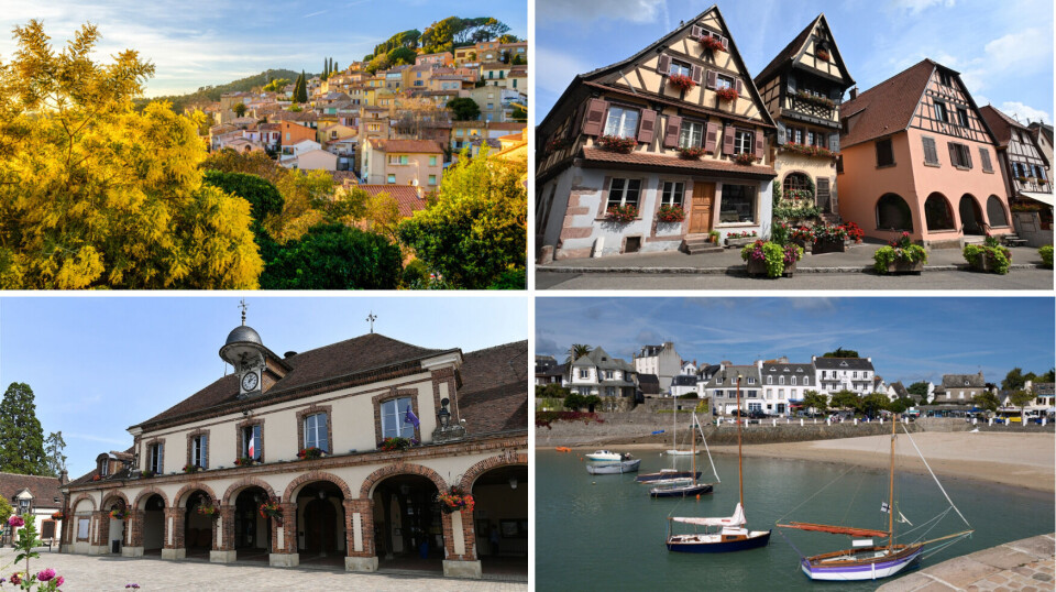
France’s Favourite Village 2026 announced tonight: how to watch
How and when to tune in to find out which of the 14 shortlisted villages received the most votes
-
Heatwave in France: will it last longer than expected?
Plus update on wildfires still blazing in several areas
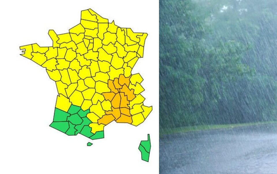
South-east France still under storm alerts after unsettled night
Gard and Hérault saw up to 100mm of rain over an hour last night, and – along with nine other departments – will see more storms today
[Update September 7 at 12:00 - Var and Alpes-de-Haute-Provence have also been placed under an orange storm alert in the latest update.]
There are 11 departments still under an orange weather alert for storms and/or the potential for flash flooding today (September 7), after heavy rain overnight.
The departments are: Ain, Rhône, Loire, Haute-Loire, Isère, Drôme, Ardèche, Gard, Vaucluse, Bouches-du-Rhône and Hérault.
Gard, Hérault and Vaucluse are also under an orange warning for heavy rain and flash floods.
🔶 11 dpts en #vigilanceOrange
— VigiMétéoFrance (@VigiMeteoFrance) September 7, 2022
Restez informés sur https://t.co/rJ24zzmmy4 pic.twitter.com/lrEZudT2RU
A further 74 departments – covering all but the south western corner of France and Corsica – are under yellow storm alerts.
Gard and Hérault were placed under the highest level of alert – red – yesterday evening (September 6), but then were downgraded to orange in the evening. However, Gard returned to red overnight, as Nîmes saw around 135mm of rain come down in one hour.
Un #orage violent quasi stationnaire affecte la ville de #Nîmes où l'on observe de nombreuses inondations dans les points bas de la ville. Soyez vigilants et restez informés sur https://t.co/KA0Ij27Eea pic.twitter.com/LSBbJU21WE
— VigiMétéoFrance (@VigiMeteoFrance) September 6, 2022
Montpellier (Hérault), for its part, saw 70mm over an hour.
Today weather conditions are expected to remain unstable, although there will be calmer moments.
Storms will begin affecting the areas under orange alerts again from around midday, and the weather warning is set to remain in place at least until the early hours of tomorrow morning (September 8).
Residents will see significant lightning activity, hail showers, wind gusts of 80-100km/h and 30-60mm of rain in a short period of time.
In some areas, 100-130mm of rain will fall.
Do I need to do anything?
People in departments affected by today’s orange alerts should:
- Keep away from trees and bodies of water
- Shelter in a sturdy building
- Keep up to date with the situation
- Secure possessions which could be blown or washed away
- Avoid going out if possible
- Avoid driving down a flooded road if they must go out
- Not go down into cellars or basements
Why was Gard’s red alert reintroduced overnight?
Gard was first put on red alert for storms as significant damage was expected to occur, and Météo France was seeking to encourage people to stay at home. The storms then shifted out towards the sea, and the warning was downgraded.
However, the Mediterranean is still very warm after the summer heat, and this fueled storm clouds which then moved back towards the mainland.
Météo France had not been able to predict that this would happen, which is why the red alert returned at around 02:00 this morning.
“It was by observing that the storms were beginning to linger that the red warning was triggered,” it said.
Read more: Worries over fish and ecosystem as Mediterranean sea set to reach 30C
Despite the volume of rain which fell yesterday and overnight, the damage caused so far has been minor.
Three people sustained slight injuries in Gard, according to the department’s firefighters, and 15 people trapped in their cars had to be moved to safety.
Related articles
Strange skies above central France: What is an ‘arcus’ cloud?
Hot summer boosts gecko numbers in south-west France
Dordogne town battered by hail is left in limbo by French insurers