-
Videos: Tennis ball-size hail batters western and central France as more storms loom
Homes and cars damaged as violent storms bring flash flooding and giant hail
-
Family in eastern France struggles with hundreds of bats living in their home
Bats are a protected species in France meaning they cannot be disturbed
-
Another department announces return to 90km/h speed limit from 2027 on many roads
Isère becomes one of more than 50 departments to restore higher limits
Bordeaux 35C, Pau 34C, Tours 32C: how long will the hot spell last?
Record-breaking weather is particularly affecting the south-west
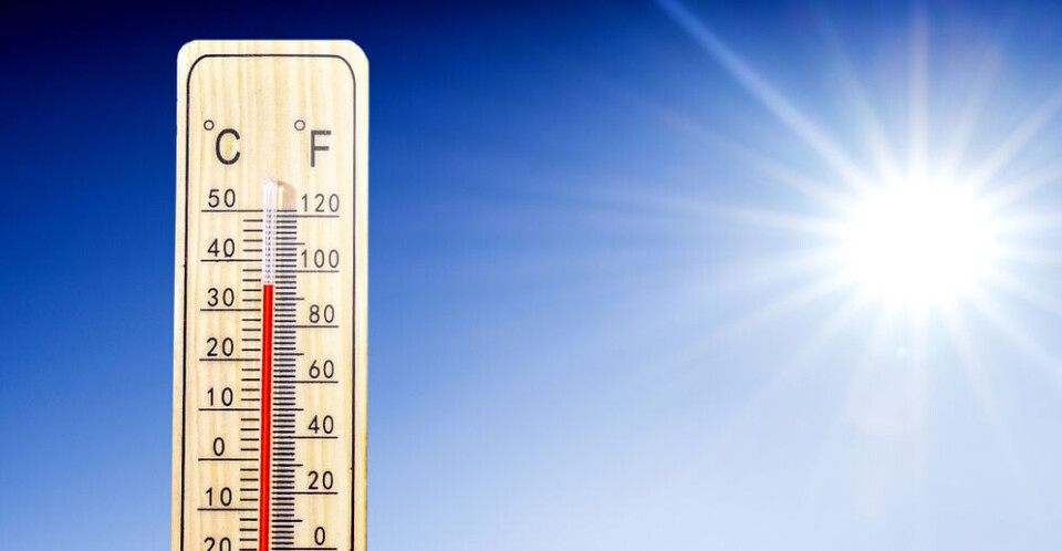
France is bracing itself for another extremely warm start to the week with temperatures remaining around 10-15C above seasonal averages.
In the south-west, highs of 36C in the area around Béarn in the Pyrénées-Atlantiques are expected, alongside 35C in Bordeaux and 34C in Pau as the area faces the brunt of the hot weather.
Elsewhere, temperatures are still far hotter than usual for the beginning of October and are set to break records, including the highest temperature ever recorded in the month across the country.
Over 300 local October heat records were broken yesterday (Sunday October 1), mostly in the south-west.
A partial end to the unusually warm weather will come tomorrow when cooler temperatures sweep in north from the UK, bringing average temperatures down by between 5C and 10C in most areas apart from the Auvergne-Rhône-Alpes where the heat will remain.
However, even where temperatures do drop, they are likely to climb again by the end of the week.
Could the absolute heat record be broken today?
The south-west is again experiencing abnormally high temperatures, being hit by warm Atlantic winds and cloudless skies.
The area saw dozens of October heat records for this time of year tumble on Sunday, most notably in Toulouse (33C compared to the previous 30.8C of 2011), Montauban (34,2°C against 1985’s 32C) and in Albi’s 34.3C, the hottest temperature seen so far this October.
Today (October 2) Bordeaux could record a 35C high and areas around Béarn 36C.
If attained, France’s overall October heat record will be broken. The current record is 35C, recorded in Ajaccio on the island of Corsica in the Mediterranean sea in 1988.
In mainland France, the record is 34.7C, recorded in Dax in 1985.
All of France affected
All of the country is experiencing temperatures far above their usual levels.
In parts of the centre-west, temperatures are approaching 15C higher than averages for the beginning of October and around 10C higher elsewhere.
▶️ Lundi 2 octobre : pic.twitter.com/3ZMUPs1vMw
— Météo-France (@meteofrance) September 29, 2023
On the Mediterranean coastline, morning temperatures today were significantly higher than usual with Nice recording around 19C at daybreak and Perpignan 18C at the same time.
Surprisingly, aside from the tip of the Breton coast, the 26C along the French Riviera is one of the ‘coldest’ temperatures expected in France today.
Aside from the south-west, highs of 32C in Tours (15C warmer than usual for this time of year), 33C in Limoges, and 30C in Strasbourg are predicted.
Because of the cooler overnight temperatures however, which allow homes and people to cool down, there is no risk of any official ‘heatwave’ (canicule) being declared.
Read more: Why are temperatures rising again in France: how warm and how long?
When will the weather cool down?
Forecasters predict a drop in temperatures from Tuesday as cool weather pushes into the north from the UK.
Rainfall across much of the country will help to bring temperatures down and on Wednesday cloudy skies will maintain the drop.
Towards the end of the week, however, temperatures will begin to rise again, and could be pushing the mercury up to 30C in the south-west and central France by Saturday.
Early predictions for next week’s weather (starting October 9) sees a similar pattern with a definitive ‘drop’ towards autumnal temperatures maybe not taking place until nearer the end of October.
Related articles
‘Face the reality’: France ‘must prepare’ for +4C global warming


