-
Brittany beach ranked among the world’s most beautiful - but you cannot visit
Visitors entering the turquoise shoreline risk a fine
-
Normandy D-Day beaches gain UNESCO World Heritage status
Cathar castles also added as ‘Royal Fortresses of Languedoc’
-
Why one south-west France village is overrun by mosquitoes
'Several thousand larvae per square metre' in lake after flooding
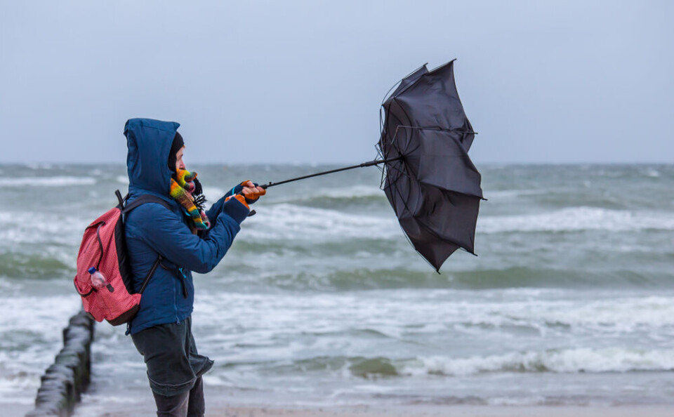
Most of western France facing alert for storms
Warnings for storms, flooding, rain, and high winds have all been raised. Some continue into the weekend
[Update 16:30: tier-three orange alerts in four departments on Atlantic coast for Friday and Saturday]
Around half of all French departments are facing weather alerts today (October 27), as storms hit both the west and east of the country.
The bad weather will continue on Saturday along the Atlantic coast.
Warnings are in place for heavy rain, river flooding, stormy weather, coastal flooding, and strong winds.
All Atlantic departments are on alert for at least two of these, due to storms rolling in from the ocean, some of which reach as far inland as Lozère and Cantal.
Elsewhere, warnings in the eastern departments – caused by another storm – and in the north on the Belgian border are also in place.
Warnings in the east will ease overnight, but in the west and north they will continue into Saturday, potentially affecting the Jacques-Vabre sailing race, which is set to depart from Le Havre on Sunday.
Departments facing combined warnings
Friday and Saturday's warnings are largely in the west of the country, caused by storms from the Atlantic ocean.
Several departments on the Atlantic coast face five separate weather warnings all at once.
Five departments are on tier-three orange warnings:
- Finistère
- Charente-Maritime
- Gironde
- Landes
- Pyrénées-Atlantiques
People are advised to avoid the seafront due to the danger of violent waves and flooding.
A number of departments also are facing alerts for heavy rainfall, forecasters La Chaîne Météo said that less rain is set to fall today than in previous days.
It added that showers would be more widespread in the affected departments, however.
One Atlantic storm will hit as far inland at the Lozère department, moving westwards from the coast throughout the day, and will end overnight.
Eastern departments close to the Swiss border will be hit with a storm during the afternoon, leaving both warnings for stormy weather and river flooding in a handful of mountainous departments.
A map of today’s warnings can be seen below, accurate to 09:00 today.
You can check the official Météo Francewebsite for updates – as a reminder, you can hover over a department to check all the warnings it is currently facing.
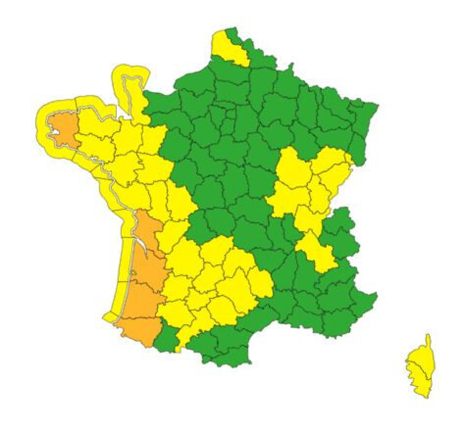
Credit: Météo France
Start time of sailing race may have to be changed
High winds are expected for the entirety of the weekend, along both the Atlantic and English Channel coastlines.
Fewer warnings are in place on Saturday (alerts are only put in place one day in advance), but gusts caused by a storm coming south from the British Isles will still be felt.
The winds will likely reach over 110 km/h in coastal areas, and could disrupt the start of the Transat Jacques-Vabre sailing race, set to depart from Le Havre on Sunday (October 29).
The race sees boats with only two crew members race across the Atlantic, however the weather warnings could delay the race’s start by hours or even days.
On top of the high winds in Le Havre and the English Channel, even stronger winds are forecast in the Atlantic at the start of next week, a threat to the small boats (usually no longer than 60 feet) taking part in the race.
Related articles
What to do (and not do) during heavy rain and flood alerts in France
Storms in France: what to do if at home, out walking or in car