-
Final days to take advantage of France’s summer sales
The original dates were extended
-
Brittany beach ranked among the world’s most beautiful - but you cannot visit
Visitors entering the turquoise shoreline risk a fine
-
Normandy D-Day beaches gain UNESCO World Heritage status
Cathar castles also added as ‘Royal Fortresses of Languedoc’
Rivers burst banks, roads flooded: north and west France on alert
There are also fears of further rainfall in the north
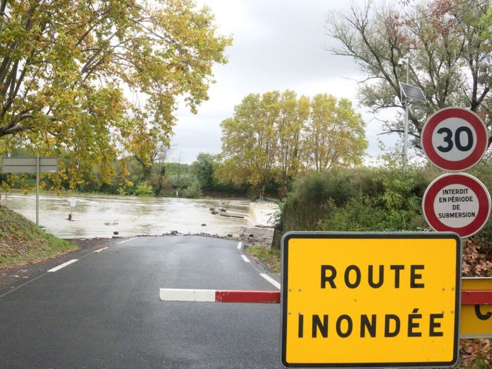
Five departments continue to face heightened weather alerts for river flooding, a week after Storm Ciaran battered the country.
Four of the departments are in the west of France, however in the northern Pas-de-Calais department severe flooding has affected dozens of communes.
The Aa and Liane rivers were on red alert for flooding yesterday (November 7) and a tier-two yellow warning continues today.
The Canche river in the south of the department remains at a heightened tier-three orange level, however, and there are fears other warning levels could rise again if more rain falls today.
Interior Minister Gérald Darmanin and Minister for Ecological Transition Christophe Béchu visited Saint-Étienne-au-Mont in the department this morning to assess some of the damage.
Mr Béchu said that the department "could reach a red alert level" by the end of the day, and that six months worth of rain had fallen in the department over the last 30 days.
Elsewhere, a dozen departments – mostly in the west of France – are facing tier-two yellow warnings for other weather phenomena including strong winds and heavy rain.
Calmer situation today, though some are worried
The situation at ground level is calmer than yesterday but people in the areas are still advised to be careful.
The Liane and Aa saw historic rises in their water level – almost a metre higher than previous records from 2002’s floods – but these have begun to slowly fall back to average levels today.
Read more: Red alert for flooding as rivers burst banks in north France
“We had five streets totally flooded and around 50 affected [since the beginning of the week],” said the mayor of Arques Benoît Roussel.
“What we've noticed since yesterday evening and this morning is that the water is receding and the roads are reappearing,” he added.
Excess water from the rivers was transported to nearby areas to prevent further flooding in the worst-hit areas, however rainfall predicted for later today is of concern.
“The water is going away, but we're afraid that this afternoon… it will come back,” said the mayor.
The department is facing a tier-two yellow warning for heavy rain, with rain falling almost non-stop since the start of the passage of Storm Ciaran on Wednesday evening.
With the soil completely saturated with water, any further rain that falls is remaining lodged at ground level (or raising the level of rivers) and contributing to the difficulty of tackling the floods.
A brief respite is currently being felt in the north, but it will start again this afternoon, and could last until Thursday evening, said meteorologist Patrick Marlière.
Residents should keep up to date with local weather reports in case warnings increase again.
Schools open but transport still affected
Schools in the department were closed yesterday, as a safety precaution, with residents being asked to stay inside.
There will be no blanket closure of schools today, however, in the worst-hit areas it will be up to local officials if schools are partially or completely closed.
The departmental prefecture said establishments in certain communes will be able to choose on a “case-by-case basis,” if they open today, including schools.
Transport in the region will definitely remain restricted, with trains unable to operate.
Trains between Boulougne-sur-Mer and Étaples (on the Calais-Amiens line) will not run until at least tomorrow morning, with disruptions potentially stretching later into the week.
🔴15h04
— TER Hauts-de-France (@TERHDF) November 7, 2023
Axe : Calais ↔ Amiens
Interruption des circulations dans les 2 sens entre Boulogne et Etaples jusqu'au jeudi 9 novembre dans la matinée à cause d’inondations sur les voies. pic.twitter.com/cSTAIsP5xU
Hopes of final day of storm chaos in west
It is looking likely that the worst effects of Storms Domingos and Ciaran will be over by the end of the day in the west.
Four departments in the area - Gironde, Dordogne, Charente, and Charente-Maritime - are on a tier-three orange warning for river flooding.
The Boutonne, Charente, and Dronne rivers in the departments are facing tier-three orange alerts along certain stretches for flooding (although the warnings do not apply to the entire length of the rivers).
A handful of other departments in the area are also facing tier-two yellow warnings for flooding. You can see which rivers are affected using the official Vigicrues website.
Early forecasts for Thursday (November 9) are that less than 10 departments will be facing warnings of any type, and that none will be higher than a tier-two yellow alert.
These departments are mostly situated on the western coast, but the risks are much lower than at the start of the week.
As a reminder, alert levels are issued by Météo France and subject to change throughout the day. You can keep up to date with accurate reports on the official website.
Related articles
SEE: Dramatic scenes of storm Ciaran battering north-west France
What to do (and not do) during heavy rain and flood alerts in France