-
New map shows where ticks are prevalent in France
People spending time outdoors are advised to ‘be prepared’ against the disease-carrying parasites
-
Chance to win a €1m Picasso with a €100 ticket in Paris raffle
Tickets are now on sale ahead of the draw later this month
-
British snowboarder found dead in French Alps after cliff fall
43-year old man fell 100 metres while snowboarding off-piste
PHOTOS: snow in Brittany and 180 km/h gales as storm Nelson arrives
The storm hit the north and west of France overnight. Train services are disrupted
[Update March 28 at 16:15: Orange tier warnings have been removed from all departments for March 28. However from midnight (the beginning of March 29) tier-three alerts for heavy winds will be in place in the Loire and Rhône departments.]
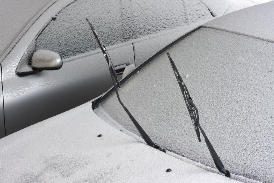
The sudden arrival of a fierce Atlantic storm in the north and west of France led to stormy weather and gales last night (March 27), as well as rare March snows in Brittany.
Several centimetres of snow fell in parts of the Finistère department overnight, as temperatures dropped by 11C in a few hours.
The storm, dubbed Nelson, quickly pushed in from the Atlantic yesterday evening, bringing gales of 183 km/h to la Pointe du Raz (Finistère), more than 50 km/h stronger than expected.
In the regst of the region multiple areas recorded winds of more than 100 km/h.
Up to 70mm of rain is forecast in parts of Brittany around the Monts d'Arrée area in the north-west, and waves of potentially eight metres along the Finistère coast.
The winds will continue throughout this morning but will die down by the evening, as the storm moves inland and loses much of its strength.
Six departments in the north and west are currently facing heightened weather alerts, all for strong winds.
These are: Finistère, Côtes d’Armor, Loire-Atlantique, Vendée, Deux-Sèvres and Charente-Maritime.
In the south, the Var is also on heightened alert for coastal waves.
Advertisement
These alerts are scheduled to be reduced to level-two warnings in the afternoon.
Although the south is experiencing a calmer day, storms are set to pick up again over the Easter weekend. Significant snowfall is also forecast for the east.
Read more: Storms, snow and strong winds forecast for France over Easter
Snow in Brittany
Residents across Finistère were taken by surprise with the snow, which is rare at this time of year in the region. It fell overnight but had mostly disappeared by the morning.
You can see photos and videos of it shared on social media below.
[ BRETAGNE ]
— Alexandre (@alex_le_bars) March 27, 2024
La dépression #Nelson pointe son nez.
Nette baisse de la température dans le Finistère. La neige tombe ce soir dans le secteur de Brest.
(27/03/24 📹 via akhy_y)pic.twitter.com/GaqfsLDqqQ
❄️ Il neige un 27 mars dans le Finistère ! Les pluies intenses se sont transformées en neige par isothermie dans le nord du département, ici à Lanhouarneau. (© Dan Cabon) pic.twitter.com/edvK6mq2Qs
— Météo Express (@MeteoExpress) March 27, 2024
❄️ Images de la #neige s'invitant par isothermie sur le nord du #Finistère ce mercredi soir, ici depuis #SaintUrbain. Rare dans la région un 27 mars ! (vidéo Julien Poupon) pic.twitter.com/bOvIauPBbD
— Guillaume Séchet (@Meteovilles) March 27, 2024
Il neige en Bretagne 😍 pic.twitter.com/mfLtQ25iIt
— 💃Silver Rose 🍰 karma is a cat 🌹 (@LittleFriendsHQ) March 27, 2024
Further snowfall is not expected today and temperatures are unlikely to drop to the same degree this evening.
Read more: 4 tips to stay safe and check icy roads in real-time in France
North faces disruptions
Regional authorities in the north are warning that some services will be impacted today due to the storm.
The SNCF said some regional TER trains would not run in both Brittany and Normandy due to the winds.
🍃Alerte orange METEO France
— SNCF NOMAD TRAIN (@train_nomad) March 27, 2024
⚠La tempête Nelson traversera l'ouest de la Normandie ce jeudi 28 mars.
🚆Les circulations seront interrompues toute la journée de jeudi entre :
Caen↔️Cherbourg
Caen↔️Granville
Granville↔️Rennes
Granville↔️Argentan.
Vous pouvez consulter l'état de… pic.twitter.com/7li6XyoHic
High-speed TGV and Ouigo services are not affected.
In the Vendée, high winds have caused many trees to blow over, with firefighters being called out a number of times.
⚠️PHÉNOMÈNE VENTEUX SUR L’ÎLE D’YEU - Plusieurs témoignages font état de nombreux dégâts sur l’Ile d’Yeu au passage d’un phénomène venteux non déterminé. De très nombreux arbres sont à terre et des toitures sont endommagées.
— Climat Vendée (@ClimatVendee) March 27, 2024
📸Nelsie Rouet pour @ClimatVendee #Tempete #Nelson pic.twitter.com/qU5gceGFMV
Some local roads may still be blocked.
Almost all of France is facing at least a tier-two weather warning of some kind throughout the course of today, mostly for strong winds or rain.
You can keep up to date with all the information via the official Météo France website.
Note that these alerts are often updated during periods of unstable weather, and are subject to change multiple times throughout the day.
Read more: What action is advised with different Météo France weather warnings
Related articles
What to do (and not do) during heavy rain and flood alerts in France
France’s state weather forecasters on strike over automation errors